Dalarö
 |
Fall colors by the sea in Dalarö.
|
 |
Eva’s 19th century cottage.
|
 |
Dalarö’s tiny picturesque streets are more like paths: so steep
they’re often staircases, windy, and lined with cabins and cottages.
|
 |
The water is never far from view in Dalarö. Houses jostle for water views and space
around the numerous unbuildable rock outcroppings throughout the village.
|
 |
My favorite Dalarö house has a tucked away entry on the back side
of the house. The little back terrace is
jammed between a rock cliff and the house, but it is charming despite its tiny
size. The front side of the house has
open views of the water.
|
 |
While there are quite a few older structures in Dalarö, many
of the larger, more prominent houses are from Dalarö’s Victorian period.
|
WEDNESDAY, OCTOBER 17, 2012
Finnhamn
 |
| The sign and ferry-waiting hut on the dock at Finnhamn. |
My mom left a couple days ago after a two week visit. It was wonderful to see her and to show her a
bit of this gorgeous place I now have the opportunity to enjoy every day. While she was here, we did a few of the
standard tourist things such as walk around Gamla Stan and go to the Vasa
Museum, but we also had the time to do a few things that aren’t on the standard
tourist itinerary. One of these was a weekend
trip to stay at the hostel on Finnhamn, an island a few hours out in the Stockholm Archipelago.
 |
| Finnhamn's hostel. |
It has been quite a rainy fall, but the weather cleared for
our trip and we enjoyed a gorgeous weekend with blue, sunny skies. The archipelago is atmospheric in the rain,
but it is at its best when the water is sparkly and the greenery vibrant.
We took the ferry from downtown Stockholm about 3 hours out
and debarked at Finnhamn. It was about a
10 minute walk from the dock to the hostel.
The hostel met the boat with a four-wheeler-pulled wagon for everyone’s
luggage, making the walk even easier.
 |
| View from the ferry on the way to the island and the ferry that picked us up at the end of the weekend. |
The hostel was originally a summer house built by a wealthy
coal merchant in 1915. The city of Stockholm
bought the property in the 1940’s to save it from “private exploitation.”
Stockholm developed the building and land into a “recreation reserve” and built
about 20 small cabins which are scattered throughout the woods on the
island. In addition to recreation, the
island is also home to a small organic farm.
 |
| One of the small vacation cabins on the island and the free-range chicken yard and hen house. |
The farm has a little farm stand where you can buy fresh
produce and homemade products like infused olive oils and rhubarb jams. Like most farm stands in Sweden, the stand on
Finnhamn operates on the honor system.
You are trusted to pay for what you take (a scale is provided but you
have to do your own math) and to not raid the money box. However, the Finnhamn farmer is more trusting
than most. The moneybox didn’t just
contain enough money to make change; there were hundreds of dollars’ worth of
coins and bills! We bought golden beets,
yellow heritage tomatoes, and a half-dozen free-range eggs. We roasted the beets and just sliced the
tomatoes as accompaniment to our dinner, and the eggs made particularly
delectable soft-boiled eggs for breakfast.
The conversion of the house to hostel was quite successful. The large dining room with two working
fireplaces is quite cozy (even if I would have chosen different decor) and the
rooms, while basic, have a certain charm due to the old wooden floors and
large, old windows. The views from the windows
at the back of the house and from the back deck over the cliffs to the water
are amazing.
 |
| View from the hostel's third floor. |
We spent both days walking the island as well as all the
connecting islands. Because the land is
still rising up out of the water after the ice age, pieces of land that were
once separate islands have now grown together.
Finnhamn is now physically connected with several other small islands,
creating a larger island. One island is nearly connected and a bridge spans the
distance over the narrow intervening waterway.
 |
| Some views from our walks. |
The island has one small, not-quite-one-lane gravel road running
through it. There are no cars on the
island but several four-wheelers transport baggage, hay, and whatever else for
the hostel and the farm. The rest of the
island is covered in a network of narrow, informal and unmarked paths. While the paths are unmarked, the island is
small enough that you’re never far from water, so it’s hard to get lost.
 |
| The island's road as it passes through the farm. |
One highlight of our walks was the fall colors. The leaves were just gorgeous, both in the
trees and on the ground. Even the marsh
reeds were golden in the sunlight. The
archipelago islands are always beautiful, but I discovered that in the fall,
the blazing colors make them absolutely stunning.
 |
| The first weekend of October was a great time to be out in the archipelago. I imagine the second and third weekends would be lovely as well. |
Another highlight was that we found a bunch of edible
mushrooms! It was so cool. At one point, Carl and I were walking through
a meadow and he pointed into the woods and said, “that looks like mushroom
territory.” Sure enough, after a short wander in the trees, we spotted tons of
mushrooms. We hadn’t thought to bring a
bag with us, so we ended up using Carl’s knit hat to collect the autumn
chanterelles. The next day on a long
walk with my mom, we were foresighted enough to bring a few bags. We found tons of mushrooms to take back with
us to Stockholm. Some of the mushrooms
we ate right away, but we did manage to save a few and dried them for use this
winter.
 |
| Fresh in the field and dried at home. |
We spent the evening hours cooking (everyone in the hostel
was jealous of our fried mushrooms whose lovely scent wafted from the kitchen
into the dining room!) a three course dinner and playing canasta in the common
dining room. It was a delicious and cozy
evening.
 |
| A sunny corner and a dining table view in the hostel's dining room. |
We took the evening ferry back to Stockholm and arrived just
as darkness was settling in and the city lights were twinkling on. It was a wonderful trip and I’m already looking
forward to our next archipelago adventure, whenever and wherever that might be!
 |
| My wonderful viking husband. |
WEDNESDAY, AUGUST 22, 2012
Hundreds of Reindeer, 269 Kilometers, 24 Days, 1 Fox, and 0 Sunsets in Lappland, Part 2: Sarek National Park
Pre.S. To enlarge an image, just click on it.


We celebrated another week of successful hiking and the
crossing of the road that bisects Kebnekaise and Sarek National Park
with a three course dinner at Saltoluokta Mountain Station. We were just as eager and ravenous for “real”
food as we had been at Kebnekaise, and we spent a relaxing afternoon in the
lounge looking forward to our dinner.
Saltoluokta’s dining room was much smaller than Kebnekaise, and there
was only one dinner seating. At 6:30,
everyone gathered in the lounge, and the waiters called each party by name and
sat them at a table. They had worked out
the seating arrangement in advance to most efficiently use every chair in the
restaurant, so the dining was family-style.
We sat with a group of four middle-aged folks that had just finished a
week-long trip on a more southerly section of Kungsleden. It was fun to hear about their experiences,
and to test my Swedish. I managed to
understand nearly everything they said and to communicate our experiences on
the northern Kungsleden in Swedish! I
was very proud of myself.
 |
| Saltoluokta Mountain Station and the guest hallway upstairs. The walls are hand-painted with Sami-esque figures including canoes, trees, people on skis, birds, foxes, reindeer, and moose. |
Dinner was fabulous.
The first course was a salmon soufflé served with several different
pasta and vegetable salads as well as fresh rolls and butter. The soufflé and bread was incredible, and my
favorite salad consisted of roasted red, yellow, and orange bell peppers in a
vinegar dressing. Both dishes were to
die for. The main course was a large reindeer
cutlet cooked in a tomato carrot sauce.
The reindeer was incredibly tender and flavorful, and the meat
practically melted in my mouth. It was
served with potatoes and more salads and bread.
After the reindeer, I was stuffed, but I managed to squeeze in the tasty
cold rhubarb soup topped with a dollop of freshly whipped cream and a mint
leaf. The mint and rhubarb worked
surprisingly well together, and the desert was a refreshing end to a dense but
satisfying meal.
 |
| Saltoluokta's two loungy areas and the dining room, all with original site-built furniture from 1916. |
Our original plan was to continue a bit south on Kungsleden
from Saltoluokta and then turn into Sarek and walk across the park from east to
west. However, after dinner at
Saltoluokta, we talked to a group that had just completed our intended
route. They strongly recommended against
going through Basstavágge because it was still covered in quite a lot of
unstable, unsafe snow.
Taking the group’s advice, we turned around, went back to
the road, and caught the bus west. Our
new plan was to do a much lower-in-elevation loop through Sarek beginning and
ending near the Kisurus cabin. The new
route would require us to backtrack about 15 kilometers, but it was better than
post-holing through unsafe snow.
In many ways, Sarek
National Park is a lot
like the areas around Kebnekaise and Kungsleden. There is an over-abundance of water that is
safe to drink right out of the stream.
Wildflowers surprise you everywhere.
There are hundreds of glaciers among high, jagged peaks. High-alpine scenery and vegetation is the
norm, even at relatively low elevations.
Hundreds, if not thousands, of reindeer roam freely through the alpine meadows. Foxes, wolves, moose, brown bears, and lynx
are around, although people rarely see them.
 |
| Some of Sarek's incredible scenery. |
But in many important ways, Sarek is a whole other world of
hiking. Intentionally left more wild than
any wilderness area in the US,
there are no trails, no cairns,
and no signs. Knowing how to navigate
with a map and compass is an absolute requirement for hiking in Sarek. There are no emergency cabins, overnight
cabins, or mountain stations. (There are
a few Sami reindeer herding cabins, but these are generally locked and not
available to hikers.) There are no bog
bridges to help you through the mud and through swampy areas. With the exception of one seasonal bridge in
the middle of the park that makes a traverse of the park possible, there are no
bridges over Sarek’s numerous gushing glacial streams, and hikers often have to
pause by a stream for a day or two in order to allow it to retreat to a flow
that is safe to cross.
Sarek is Western Europe’s last true wilderness, and Sweden intends
to leave it that way. However, Sarek’s
website does contain a warning that despite this, Sarek is not quite as wild as
you might think. With 2000 visitors a
year, you’re likely to see another soul or two during your hike. 2000 visitors a year! A place like Yosemite
must get 2000 visitors an hour during the summer! Even Gates of the Arctic
National Park in northern Alaska gets about 5
times more visitors a year than Sarek.
 |
| Since Sarek has no real trails, we had to forge our own path through the wilderness. Luckily, the landscape is very open so it's hard to get too lost. |
The park’s website warning was correct: we did see several
other people during our hike. But that
wasn’t until we got into one of the parks main bisecting valleys. When we were hiking in some of the park’s
side valleys, we didn’t see another person for several days.
We started our hike by hiking into Guohpervagge, which by
looking at the map, must be incredibly impressive with sheer walls tumbling
thousands of feet from the peaks down into the valley. But by this point in our trip, the weather
had deteriorated from cloudy with occasional rain to heavily cloudy with nearly
constant rain. We continued hiking with
the hope that the weather would eventually clear and we’d get views of the
beautiful mountains we were walking by.
But a couple days into our trek into Sarek, we began to loose hope, and
the continual rain, near-freezing temperatures, and desolately cloudy landscape
really got to me. What’s the point of
walking if you can’t see the scenery you’re walking through?
 |
| Walking walking walking. While it was quite cloudy and rainy, we were fortunate to have amazing views every now and then along the way. |
We’d had enough. We
decided to cut our Sarek trek short and shortcut through Sierggavágge in order
to make our way back toward the road.
But later in the morning, the clouds lifted just enough to allow views
up to some of the valleys peaks. Our
spirits lifted with the clouds, and instead of turning toward the road at the
end of Sierggavágge, we walked farther into the park up Ruohtesvágge. Unfortunately, though, the clouds descended again in the afternoon and it began to
rain on and off. That evening, we found
a perfect tent site during a break in the rain, but when we put our packs down
to start setting up camp, the rain moved in again. It poured for about 20 minutes, and we just
stood there, in the sheeting rain, waiting for it to die off so that we could
set up our tent without the interior of it getting soaked. It was a depressing moment, standing there in
the near-freezing rain. But the rain did
let up again, and we were able to successfully get our tent set up and our
stuff inside before the rain began once more.
 |
| One of our incredible campsites. Despite all the rain, we did get a few moments of good views nearly every day. |
Generally, over the next four or five days, it rained. We moved a bit farther into the valley, but
with so much rain and so few views, we weren’t very motivated to get out of our
tent and walk in the rain. We spent most
of the time holed up in our tent, reading, playing cards, and snoozing. During brief pauses in the rain, we’d rush
outside, dance around in the dry air, furiously set up clothes drying stations,
and enjoy whatever views the clouds were revealing at the moment. Soon enough, we’d start feeling drops of
water again, so we’d bundle everything back into the tent and wait it out until
the next dry spell.
 |
| Drying clothes between rains. |
The rain and clouds parted just enough to give us amazing
glimpses of Sarek’s majestic mountains and glaciers. We saw just enough to know what we were
missing, and to want to return to the park one day. Eventually, our time started to run out, so
we slowly made our way back to Kisurus Cabin.
 |
| Kisurus Cabin, its kitchen, and its dining area. The giant gas tanks on the cabin's front porch power the kitchen stoves as well as gas heaters in each of the bedrooms. |
We were so tired of being wet and hiding in our cramped tent from the
rain that we decided to splurge on some bunkbeds. Our room had four beds, but luckily, no one
joined us. We were able to spread all of
our wet gear, clothes, and our wet tent out in the room. Having a dry space to hang out in was
absolute luxury, and we spent the evening in the kitchen/dining room reading
and talking with other guests.
 |
| Half of our bunkroom and a fun system for keeping track of how many beds are already claimed in the room. |
Our second to last day of hiking was partly sunny and
beautiful. The clouds rose high enough
that we got good views of the surrounding peaks. At last!
Finally! It was so warm in the
sun that we bathed in a stream, something that we had only had the warmth and
courage to do once before on our entire trip.
Because of our newly revealed beautiful surroundings, it felt
disappointing to be hiking out of the mountains just as the weather was
clearing up.
 |
| Sunny day with clear views. |
But we didn’t have to worry: our last day of hiking was cold
and rainy with no views. We got to the
road without regretting that it was the end of our trip. We were ready for showers, our own bed, real
food, and more space than the tent could offer us. After an afternoon and night at Ritsem (avoid
this cabin if you can, it’s location is potentially gorgeous but it is more of
a junk yard than a mountain cabin) where we showered, played lots of cards, did
some laundry, read, wrote postcards, and enjoyed frozen pizza for dinner (what
luxury!), we got on a bus and then the night train back to Stockholm. Twenty-one hours after setting off, we arrived in the city.
Despite all the rain, overall, it was a marvelous
journey. We saw so much and enjoyed an
incredible amount of breathtaking scenery.
We had plenty of time to relax and enjoy ourselves. We can’t wait to get back up to the region
another summer to climb Kebnekaise, to really hike through and see Sarek National
Park, and to hike the southern sections of
Kungsleden. We’re also eager to get up
there in the winter to cross country ski from cabin to cabin.
Back in Stockholm,
we’ve been enjoying getting back into our everyday routine (and to our comfy
bed and to real food with veggies). We
came back with more energy to work on our apartment, and we’ve already crossed
several projects off of our too-long, too-delayed list (although we’ve also
added some projects to the list, too…).
I also came back with more focus and energy for studying Swedish, and I
feel like I’ve been making good strides these last few weeks. Having such a long vacation gave us energy to
be productive and to savor our everyday life.
Hopefully this newfound energy will last!
FRIDAY, AUGUST 10, 2012
Hundreds of Reindeer, 269 Kilometers, 24 Days, 1 Fox, and 0 Sunsets in Lappland, Part 1: On and around Kungsleden
Pre.S. To enlarge an image, just click on it.
Carl and I are recently back from a three-and-a-half week
hiking trip up in the very northernmost region of Sweden. The very fact that we were able to take a
three and a half week vacation is amazing enough, but the scenery absolutely
knocked our socks off.

In Sweden,
five weeks of vacation is the minimum legal amount of paid vacation. Five weeks!
And legally, your employer must allow you to take at least three of
those weeks consecutively. Because July
is the warmest and nicest month, disappearing from the office for the entire
month is the norm here. And because overtime
compensation is hour-for-hour in many companies, it is not unusual for people
to take seven consecutive weeks of summer vacation, only half of which is
depleting the vacation bank. Generally,
it is accepted that not much work is going to get done from the middle of June
through the middle of August, and that’s ok.
The summer break in work is considered a necessary prerequisite to being
productive September through May (with the exception of two weeks at Christmas
and 16 public holidays).
My school break was the month of July, so this year we had
little choice about when to take our vacation.
The day after we got back from canoeing in Färnebofjärden, we hopped on
a plane up to Kiruna. From Kiruna, we
caught a bus which took us to Abisko, the northern start of the Kungsleden.

Kungsleden, or The King’s Trail, is Sweden’s equivalent to the Appalachian
Trail, although it is much, much shorter at 400km/250miles. Northern Sweden
is also home to several other long-distance hiking trails including
Padjalentaleden and Nordkalottleden, but Kungsleden is by far the most famous
and popular.
It’s hard to loose your way on the Kungsleden. The path is well worn and well marked with cairns. It is a very developed trail with miles upon
miles of bog bridging, bridges over many of the rivers and streams, overnight
cabins spaced a day’s walk apart, and emergency huts placed in potentially
risky spots like the high passes. Each
of the cabins has an emergency telephone (satellite?) and is staffed with
volunteers that are trained in CPR and first aid. Helicopters are a fairly common sight, mostly
ferrying goods around the remote region and ferrying lazy tourists to fishing
lakes, but they are also available for emergency search and rescue and
emergency evacuation purposes. Although
the scenery is high alpine magnificence, hiking the Kungsleden is very cushy
and safe in comparison to many other remote areas I have experienced.
 |
| The trail is so well traveled that cairns aren't really necessary, but they sure are cool. |
In addition to the above, the Kungsleden has another
advantage that makes hiking in the region much less strenuous: about
every-other cabin sells food. The food
is shipped in on snow mobile-pulled sleds in the winter and is available for
purchase year-round. Although the pasta,
hard bread, muesli, candy bars, and other long-shelf-life foods are quite
expensive, even by Swedish standards, it’s worth the price to only have to
carry a couple days’ food at a time since food is usually the heaviest item in
your backpack. (Two days of food for two
people cost somewhere around 400kr, or about $60. That’s a lot of money for pasta and powdered
pasta sauce, but cheaper than a chiropractor!)
 |
| Signage was limited to just outside the cabins, but it wasn't really needed. |
Another pack-lightening “amenity” of Kungsleden is the
abundance of water. I have never seen so
much water in my life. Literally. For every stream marked on the map, there are
eight or ten times as many streams in reality.
For every pond or lake on the map, there are actually at least two or
three times as many. In addition to all
of the streams, rivers, ponds, and lakes, entire valleys were covered in watery
bogs and entire mountainsides were sheeting water downhill into the rivers. It’s hard to be precise, but I’d guess that at
least 50% of our steps were literally in or over water. All of this water means that you don’t have
to carry much water around with you.
Carrying half a liter at most between two people was quite a contrast to
hiking in Texas
where a backpacking trip is limited to three days because you have to carry six
gallons of water! I’ll take carrying a
pound of water per person over carrying 24 pounds of water per person any day!
 |
| Water water everywhere, and every drop to drink. I'm only showing large, impressive bodies of water here, but just imagine that small brooks are babbling everywhere, too. |
And the even more amazing thing about all this water: it is
100% drinkable and safe as-is and doesn’t need to be filtered or treated with
iodine. In fact, many of the hikers we
passed weren’t carrying any water bottles at all. Instead, they had small plastic cups clipped
to their shoulder straps. Whenever they
felt thirsty, they’d just dip their cup into a stream and drink. This sort of behavior is unthinkable in the US where every
single spring, stream, river, pond, and lake contains or likely contains
giardia. In some ways, Sweden truly is an Eden.
All of this water does create a downside: mosquitoes. A friend told me about a t-shirt that reads
“Kiruna: A billion mosquitoes can’t be wrong.”
I’m pretty sure that all billion mosquitoes bit us. Some days, when there was a strong enough
breeze, the mosquitoes weren’t all that bad.
But on still, warm days, the mosquitoes were beyond pesky. We had a couple of nights in the tent when
the mosquitoes were buzzing so thick around us that the tent looked almost
black and it sounded like the tent was about to take off and hover above the
ground. I have seen a lot of mosquitoes
on my various expeditions, but Kungsleden just might win out for the
mosquito-y-est place I have ever visited.
 |
| Just a small sample of the mosquitoes on our tent trying to get through the fabric to suck our blood. |
Another downside to the area’s abundant water: wet boots. My boots were thoroughly soaked all but two
days of our trip. My boots are
supposedly waterproof, but their thin GorTex layer didn’t stand a chance
against all of that water. Carl’s solid
leather + GorTex lined boots fared much better.
He frequently had damp socks by the end of the day, but very rarely was
he squelching water from the inside out with every step. We saw many hikers in hunting/duck boots or
in plain-old wellies. I cannot imagine
that it is comfortable hiking in wellies (arch support? ankle stabilization?), but at least their
socks were dry…
 |
| In addition to our boots, our clothes often needed drying, too. Left: the age-old lay-it-on-a-rock-in-the-sun method. Middle: Carl brilliantly figured out that our hiking poles would make good drying racks. Right: Sometimes we even stood outside in the wind during small breaks in the rain with socks on our hands in an attempt to dry them out. We were desperate. |
STF, or the Swedish Tourist Association, makes a very good
effort to keep your boots dry. They have
built mile upon mile of bog bridging through swampy areas. This was probably my favorite kind of
trail—smooth, easy to walk on, no mud to squelch through, no rocks or roots to
stumble on, and generally dry (although sometimes the boards had sunk down
under the water surface so you were still walking through water, just not as
deep). STF carts all the boards in
behind snow mobiles in the winter, deposits the wood along the trail, and
furiously maintains/builds new bog bridging as needed during the short summer.
 |
| I absolutely loved walking on the bog bridges. Not only was the walking easy, but the wide open spaces were just gorgeous. |
STF also provides bridges along the trail. Most of these are simple, wood affairs spanning
over small streams. But several of them
are serious bridges over serious rivers.
These rivers are wild with white water even at the end of summer when
the snowmelt has already passed through, and totally un-crossable except when
frozen. Steel suspension bridges span
over these wildest rivers. In order to
limit the span, these bridges are generally placed at the narrowest point in
the river, so you end up walking over the craziest white water on the river. Even though these bridges look solidly anchored
to land, they are still a bit scary to cross over, because you’re constantly
thinking “what if…” No person could
possibly survive a fall into the churning water. A third type of bridge is a relatively
short-spanned aluminum bridge. These
bridges are not permanent and are flown in by helicopter after the spring
flooding and removed by helicopter before the first snowfall. I get the impression that these bridges are
in locations where more permanent bridging has gotten flushed downstream by
spring floods one too many times, and the expense of flying a bridge in and out
every year is cheaper than re-building over and over. How crazy it would be to see a helicopter
flying through the mountain passes with a 30-foot-long bridge dangling below!
 |
| Two permanent suspension bridges and a seasonal aluminum bridge. |
While many of the streams and rivers on Kungsleden are easy
walking, not all are bridged. Most of
the un-bridged streams are rock-hoppable, so you can cross without getting your
boots (very) wet. But every now and
then, maybe once a day, there’s a stream that’s too deep for rock hopping. At those streams, you have to stop, take your
boots and pant legs off, put your sandals on, wade across the icy stream to the
other side, stop, let your feet and legs warm up and dry off, put your boots
and pant legs back on, and then continue on your hike. Depending on how much time you need to hop
around in pain warming up your feet before you can continue hiking, the wading
process takes from fifteen minutes to half an hour. Most of the streams we waded were about
knee-deep and didn’t feel too dangerous.
However, one or two surprised us and ended up being thigh-deep or
bottom-deep, and these were harder to cross.
Luckily, we never had any problems and despite some very slippery river
bottoms never fell or were swept downstream.
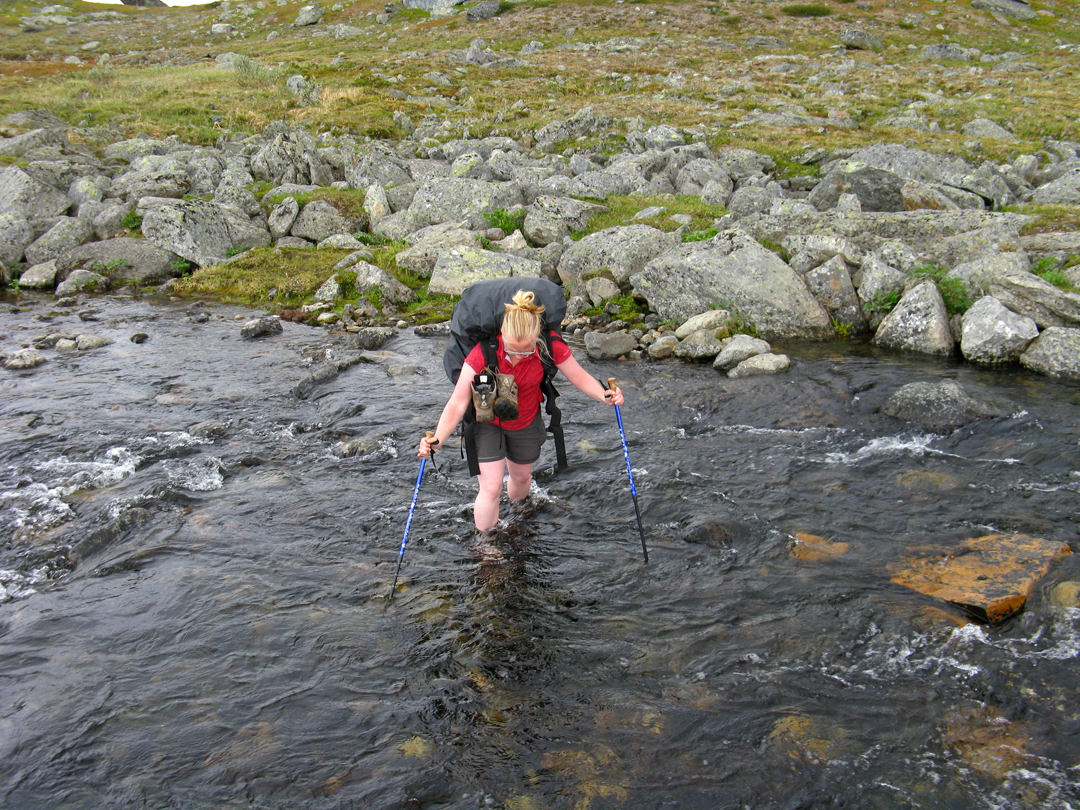 |
| This stream wasn't as deep as some of the others, but it sure was COLD! |
Where does all this water come from? General snowmelt and glacier-melt from the
area’s hundreds of glaciers, mostly.
Even though it was July, there was still quite a lot of snow remaining
in the mountains, and all of it was melting as quickly as it could and rushing
downhill. Although Stockholm
had a lower than average snowfall, Northern Sweden
apparently had a higher than average snowfall last year. The extra snow coupled with an unusually cold
June meant that lots of extra snow remained on the ground during our hike. This meant that we ended up crossing quite a
bit of snow on our hike, which was extra-challenging because we weren’t
carrying snowshoes. We did a lot of
thigh-high post-holing, always strenuous, even more so with backpacks.
 |
| We had to wade through the 100 meter wide river on the left. Next to the snow. And yes, it, too, was cold. |
All of the extra snow meant that we were forced to turn
around and change our hiking plans several times. Kungsleden generally stays in the lower
valleys and rarely climbs up to scenic passes.
When we were planning our journey, we decided that an all-Kungsleden
trip wouldn’t be scenic or challenging enough, so we planned to use the main
trail as a base from which we’d hike up into the passes and loop back down to
the main trail. Kungsleden ended up
exceeding our scenic expectations: just about every kilometer had
breath-taking, panoramic, high-alpine views.
Just because the trail didn’t climb very high didn’t mean that it didn’t
provide views into the high mountains, and we were pleasantly surprised at how
rugged the scenery was on the trail.
 |
| Going up through Tjäktja Pass didn't feel dangerous because the snow here was still quite solid. And because so many had gone before us and packed the snow down, we didn't do much post-holing on this section. |
It was just as well that Kungsleden’s scenery astounded us
since our forays into Unna Reaiddávággi and the Three Pass Trail, Kaskavagge,
Sinnjubahta, and Bastavággi all proved impossible to pass through. Three times we climbed up and up and up, only
to be forced to turn around and climb back down to the main trail for safety
reasons. We met people who did go over
these passes, but we just didn’t feel safe enough without snow shoes to
continue. Even though turning around,
backtracking, and loosing all the hard-won elevation was frustrating, it still
felt better to be safe and turn around than to take chances.
Kungsleden’s scenic views were enhanced by the fact that
even though it doesn’t generally climb very high, nearly the entire trail is
above tree line. That far north, above
the arctic circle, tree line is at about 1500 feet above sea level. During three weeks of hiking, rarely did we
dip below tree line. We were above tree
line by the second day and only saw trees two more times on our hike.
Although the trail was generally above tree line and
provided incredible alpine scenery, the elevation was quite low. The trail generally hung out at around 800m
or 2600ft above sea level, and Kungsleden’s highest point is 1300m or 3800ft
above sea level. Our highest side hike
took us to 4300 ft above sea level, and the highest peak in Sweden,
Kebnekaise, is only 2106m or 6909ft above the sea. Those elevations at lower latitudes would not
yield such stark and impressive mountains, but so far north at 67.8 degrees
above the equator, there is very little vegetation to impede views or break
down the mountains over time.
Even below the tree line, the birch trees were quite small
and only about thirty feet tall. As we
slowly gained elevation, the birches became dwarfs and then disappeared
altogether. Dense, hip-height shrubs
grew far higher than the trees, but even those petered out after a certain
elevation. Higher than the shrubs, the
vegetation was moor-like with vast expanses of heather and low bunch grasses. After about 1000m or 3280 ft above sea level,
even the heather and grasses couldn’t grow and lichens growing on the rocks
were the only signs of life. Up at those
heights, the landscape was almost lunar in its desolation: nothing but rocks
and boulders covering the ground and high, windswept, snow-covered peaks
surrounding you. At that elevation, a
color photo and a black-and-white photo looks nearly the same; the only colors
to be found up there are the grey rocks, the white snow, and the blackly wet
stones. Needless to say, finding a tent
site up there among all those stones and boulders was a challenge, but not
impossible.
 |
| Birch forest, dense shrubbery, grass and heather meadows. |
In addition to the general vegetation, we saw about thirty
different types of wildflowers.
Generally, the flowers were much smaller than wildflowers in the Rockies, but they were just as delightful, colorful, and
diverse. Among many others, there were
bluebells that eat insects, yellow butterballs growing in the swampy areas,
white cotton puffs in the meadows, purple heather, and yellow parabolic flowers
whose shape holds the sun’s warmth, attracting insects.
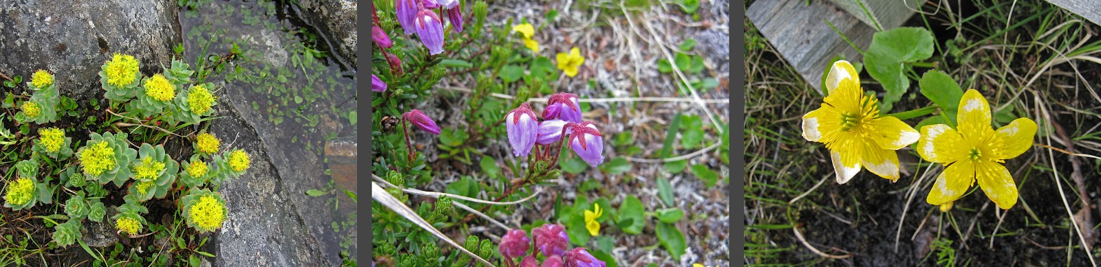 |
| Just a few of the lovely wildflowers we encountered on our trip. |
We spent 21 of the 24 nights of our vacation in our tent;
only three nights did we stay in one of the numerous cabins. While the cabins are enormously convenient,
they are quite expensive: a bed in a bunkroom costs about $50 per person per
night. In addition to a bunk, that $50
buys you dry living and sleeping spaces when it’s raining out, warmth from wood
stoves and all the wood you need for burning, drying capabilities for wet boots/socks/clothes
around the wood stove, a kitchen with pots/pans/plates/cutlery/etc and gas
stoves, and a blanket and a pillow. It
would have been a very expensive trip to stay in the cabins every night, but we
would have saved a lot of pack weight from not having to carry a sleeping bag,
sleeping pad, tent, stove, pot, and a fuel bottle.
There are three types of cabins along Kungsleden. The smallest and simplest are emergency
shelters in very exposed places. These
generally are enclosed and have a wood stove and a wood supply. They are free to use but you’re not supposed
to sleep in the shelters unless it is an emergency.
 |
| The emergency shelter atop Tjäktja Pass. |
However, most of the cabins along the trail
provide (costly) overnight accommodations.
Most of the cabins are fairly rustic with outhouses, bunk rooms, gas
cooking stoves, wood warming stoves, and wood-heated saunas. Generally, they consisted of three or four
porta-buildings that have been added over time as the numbers of guests
rose. They aren’t all that
architecturally interesting, except that the way they are anchored to the
bedrock with steel cables gives a clue to the severity of winter storms. Although most cabins had between 20 and 40
beds and beds are given out on a first-come, first-served basis, no one is
turned away from a cabin. When the bunks
run out, people sleep on the floor on extra pallets. One cabin had overnight visitor records
posted on the wall, and the record was 39 overnight guests in a cabin that is
meant to sleep 20!
 |
| Alesjaure and Nallo were two of the many cabins we passed. |
These cabins are staffed throughout the year by trained
volunteers who typically stay out in a cabin for four weeks. Guests are supposed to clean up the cabins
and fill kitchen water buckets before they leave, so the volunteers’ duties are
fairly limited to collecting fees and being available for questions, opening up
the little food stores when people ask, listening to and posting the daily
weather report, and being around in case of an emergency. In return, they get free accommodation in a
small but private room in a gorgeous location.
Sounds like a cheap but beautiful vacation plan to me! Most of the volunteers seemed to be younger
retirees, but several were in their 30’s or 40’s and were volunteering on their
work vacations.
The third type of cabin is called a Mountain Station. These complexes are much cushier and are
sleep more people. They have
electricity, plumbing, hot showers, drying rooms for wet clothing and gear,
wireless internet, private bedrooms in addition to bunkrooms, comfy lounges
with open fireplaces, electric heating, saunas, three course gourmet dinners,
buffet breakfasts, extensive take-a-book-leave-a-book libraries, game
libraries, large public kitchen/dining rooms, and guided hikes. Mountain Stations are much more expensive—a
bunk costs about $70 per person per night, and a private room for two runs
about $240 per night. While expensive,
these rooms are quite simple with two twin beds and a few hooks on the
wall. Bed linens are extra (not sure how
much) and borrowing a towel costs $10 each.
 |
| Kebnekaise Mountain Station's historic building, an expensive but simple private room, one of the several comfy lounges. |
While most of the regular cabins were fairly modern
porta-buildings, the mountain stations’ main buildings tend to be historic with
lots of character—thick stone walls and fireplaces, creaking, wide plank
floors, hand-made 100-year-old furniture in the dining and common areas, and
wavy glass windows. These buildings were
built 100 or 120 years ago and have housed countless hikers and climbers
since. The main historic buildings no
longer accommodate all the tourists that go through the mountain stations, so
they have since added layer after layer of characterless porta-buildings to
meet the demand. Kebnekaise Mountain
Station now sleeps over 200 people.
Two of three of our non-tent nights were spent at Kebnekaise
about a week into our trip. By the time
we got to the mountain station, it had been raining for 3 days, all of our gear
was wet, and intense downpours were forecast for the next 48 hours. We were exhausted and getting tired of our
cramped tent and decided to splurge on a private room. It was heaven, and we slept for 12 hours
straight on our real mattresses in our darkened room. We hadn’t originally planned to stay a second
night, but the relentless downpour meant that we couldn’t find anywhere to
pitch our tent that wasn’t a puddle, so we took beds in a bunkroom. It was a great place to be during a 48 hour
downpour because of the comfy, cozy lounges where we could spend the days
reading, drinking hot chocolate, and playing cards, but the best part of
staying at the mountain station was dinner.
 |
| The drying room, dense and humid with gear, clothes and boots. |
In addition to splurging on a private room, we splurged on a
four course dinner in the mountain station’s gourmet dining room. Actually, in comparison to the bed rates,
dinner was a bargain at about $50 per person (not including drinks). Eating “real” food was such a welcome treat after a week of slightly unsatisfying pasta
and pre-packaged freeze-dried camping dinners.
The dining room only serves a fixed menu, which considering that all
fresh food has to be helicoptered in, makes sense. The first course was an exquisite lobster
soup with the most amazing freshly baked tomato bread. (There’s an on-site bakery at Kebnekaise and
we read that four metric tons of
flour is brought in on snow mobiles every winter. All of the flour and all of the other
non-perishible goods are stored in the historic building’s basement.) Eating fresh, fluffy, warm bread with real,
creamy butter after a week of crackers was nothing short of divine. The second course was a plate of Greek
olives, proscuitto, fresh tomato, fresh basil, balsamic vinegar, and fresh
mozzarella cheese. Fresh food! Fresh food!
The main course was a perfectly cooked, tender pork loin with roasted
vegetables and a spinach risotto. The
pork was delicious, but honestly, the veggies were my main attraction. Desert was a white chocolate raspberry mousse
with tea or coffee. Oh, my
goodness. I cannot describe how amazing
that mousse was!
 |
| Kebnekaise Mountain Station's restaurant |
The funny apart about our gourmet, four course dining
experience was our attire. After a week
of hiking, our clothing desperately needed to be washed, so as soon as we
arrived at the mountain station, we took over the tub sink and hand washed all
of our nasty hiking clothes. Even though
the mountain station had a huge 400sf drying room with line after line strung
up and a huge dehumidifier/heater/blower, our clothes were not dry by dinnertime. Part of this was because all 200+ people
staying at the mountain station had their sopping gear hanging alongside our
gear and every inch of hanging space was being utilized, partly this was due to
the fact that the blower seemed undersized for the size and capacity of the
room, and partly it was due to the rudeness of some of the guests who slung
their dripping wet clothes directly over our clothes. All in all, it took some of our items more
than 36 hours to dry. So anyway, we ate
our gourmet meal in nothing but rain pants and a rain coat and bare feet.
Actually, our attire wasn’t so different from everyone
else’s. While we seemed to be the only
guests wearing nothing but nylon, the 19km hike from the road to the mountain
station meant that all the diners were pretty casual in their hiking
clothes. And everyone was either
barefoot or in socks. Like any Swedish
residence, everyone takes their shoes off at the door (I’ll have to blog about
this Swedish peculiarity further). This
means that all dirt, mud, and rain is contained to one area in the building,
making the rest of the building cleaner and easier to maintain. It was amusing to see about 80 barefoot
people eating a four course dinner by candlelight. I was also amused by the shoe chaos by the
door.
 |
| Shoe and raincoat chaos at the front door to Kebnekaise Mountain Station |
After spending about 48 hours at Kebnekaise’s mountain
station, the weather suddenly cleared, the sun shone, and we joined the mass
exodus out from the station. The sunny
day was glorious, but it didn’t last long.
Generally, our first week was the nicest with the most warm sunshine,
but it ended in the downpour that found us at Kebnekaise. The second week ended up being cloudy with
rain here and there, but it was manageable even
though the temperatures dropped and it wasn’t comfortable to sit outside. The third week wasn’t so great—we had nearly
constant rain and low clouds that occasionally lifted high enough to show us
the nearby peaks and quite chilly temperatures.
We even had a night of frost. I
get the impression that we had rainier and colder weather than is normal for
July, but I also get the impression that the steep, jaggedy mountains cause
fairly extreme micro-climates. For
example, near Abisko where we started our hike, the average yearly rainfall is
only 300mm or about 12 inches. But
slightly further south in Padjalenta
National Park, the yearly
rainfall is more than three times higher at 2000mm or about 48 inches. The peaks “catch” and funnel clouds so that
one part of the trail might be cloudy and rainy while a few miles south it is
sunny and pleasant. We seem to have
caught more than our fair share of cloudy and rainy.
In fact, of our 24 hiking days, 17 of them had significant,
hampering rainfall. Twelve of the days had
too much and too low cloud coverage to grant us much in the way of views, so
half of our vacation we couldn’t see and appreciate our gorgeous
surroundings. We did have seven sunny or
mostly sunny days, though, and those were glorious! Sadly, though, despite spending nearly a week
in the Kebnekaise region, we never caught a glimpse of Sweden’s
highest peak. One day, we hope to get
back to the area to see and climb the mountain.
 |
| With all those rainy days, we had to embrace the clouds for their own beauty even though they obscured the peaks. |
Even though the rain was depressing, it didn’t significantly
change our daily routine. Generally, our
alarm would sound at around seven a.m..
If it was raining, we’d snooze for an hour or so until there was a break
in the rain, at which point we’d furiously try to pack up before it started
raining again so that all of our stuff didn’t get soaked during the packing
process. If it wasn’t raining, we’d have
a more relaxing morning, perhaps drinking some tea with breakfast and enjoying
the views. Our morning breakfast/packing
routine takes about an hour to an hour and a half, and then we’d get
walking. After four or five kilometers,
we’d be hungry and ready to stop for a snack.
A rainy snack was usually quickly eaten standing, huddling over the food
so it didn’t get wet. A sunny snack was
more prolonged, sitting and enjoying the views.
Another four or five kilometers later, we were ready for lunch. A sunny lunch would involve a comfy sitting
rock, boots and socks off and drying in the sun, some lizard-like lounging, and
lots of gazing into the distance. We’d
then walk a couple hours more and then stop to look for a campsite.
 |
| Snack Time! |
Campsites generally had 3 requirements: as mosquito-free as
possible, near water, and relatively flat/not too bumpy. Open, windy spaces were much more pleasant as
far as mosquitoes. Finding a spot near water
was only an issue once. And amazingly, a
relatively flat and not too rocky spot was findable, even on the slopes covered
in boulders. Rarely did we have to go
far off the trail to find a perfect spot, and we were continually surprised
that it wasn’t too difficult to find a good spot that met all of our criteria.
 |
| Tent with a View. Just a few of our incredible tent sites on the trip. |
Our tent was certainly the most photographed object on our
trip. Nearly every day, we had
incredible views 360 degrees from our tent site, and the tent provided a good
scale figure to show the vastness of the landscape. Once we set up camp, we’d generally have an
hour or two for reading, journal writing (me), and sketching (Carl) before we
were starving for dinner. If it was
sunny, we’d do these activities outside, keeping an eye on all of our drying
clothes fluttering in the breeze, but if it was rainy, we’d have to hide out in
our little tent. As the trip wore on and
it got colder and rainier, we spent more and more time inside the tent. It never got quite as claustrophobic as you
might think, but by the end of the trip, we were ready for a little more space!
 |
| Carl drawing the afternoon away. |
Cooking and eating dinner never took all that long because we were cooking such
simple, easy meals. We’d often have a
dessert later in the evening, but mostly, we’d sit outside or lay around in the
tent reading or playing canasta. “Lights
out” was generally early at around nine or ten p.m., but of course, we didn’t
have any flashlights to turn out. Because
we were above the arctic circle during the summer, the sun never set. It was strange to have broad daylight
twenty-four hours a day, but it was also comforting—never did we have to worry
about finding a campsite before dark, never did you get up to go to the
bathroom in the middle of a dark night.
I didn’t have much trouble falling asleep, but Carl had to use an eye
mask in order to fall asleep. His eye
mask says “Genius at work” and it makes me laugh every time I see it. While the light didn’t seem to affect my
ability to fall asleep, it did seem to affect how deeply I slept. I only got a good night’s sleep twice on the
entire trip, and one of those times was in our private room at Kebnekaise! Sleeping in a real bed and not having to
spend the night worrying about a leaking tent was definitely one of the main
reasons I wasn’t overly sad when our vacation ended.
Luckily, we never had a big issue with the inside of our
tent getting too wet. After a very wet
experience earlier in the summer on Gällnö, we put a third layer of seam seal
on the tent. The new seam sealant plus a
new rain fly staking system seemed to curtail the leakage to a livable
minimum. Even though we never had a big
issue with leakage, it didn’t stop me from worrying sleeplessly every night
that it rained.
My continual lack of sleep and all the rain had something to
do with our diminishing mileage. At the
beginning of the trip, we were hiking about 20km or 12.4 miles a day. However, after about a week, we realized that
we were happy until about 15km, but the last 5km felt more like a forced march
than vacation. So we decided to cut our
average daily distance down to a happy 15 km or 9.3 miles. In addition to fewer miles every day, we
factored in another couple of rest days, and we had 4 total rest days and
several half days due to Carl’s aching ankle.
All in all, the slower pace suited us better and our bodies were less
worn out and our minds less stressed. Although
we curtailed our daily distances, we still walked a total of 269km or 167
miles, quite a bit of ground!
 |
| Walking, walking, walking. |
I am pretty sure that over our trip, we saw at least one
reindeer for each of the 269 kilometers we walked. However, we never saw a lone reindeer; being
herd animals, they like to stick together.
We did see several groups of three or four reindeer, but mostly, we saw
entire herds consisting of thirty or sixty animals. The reindeer didn’t seem to mind us at a good
distance, but when we walked closer in order to pass by them on the trail, they
would trot away.
 |
| Hundreds of reindeer but no red noses. |
Nearly all of the
reindeer had antlers; apparently both female and male reindeer grow a new set
of antlers every year. Generally, they
were one or two or three points but we did see a couple of older deer with more impressive antlers. Given the number of reindeer in the
area and the fact that they drop their antlers every year, we saw quite a few
on the ground.

The reindeer are herded by Sami, the native people who have
dwelled in the far north of Sweden, Norway, Finland, and Western Russia since
the ice receded seven or eight thousand years ago. In Sweden,
there is a law that only Sami are allowed to herd reindeer, and there are about
2500 Sami in Sweden
who earn their living with the reindeer.
The reindeer are semi-domesticated and roam and graze freely in herds
for most of the year. They are then
herded by helicopter and four-wheelers to a reindeer camp once or twice a year
for culling. Every reindeer in Sweden is owned
by a Sami community, and we saw several deer wearing collars or small
bells. I don’t completely understand the
ins and outs of it, but it seems that the reindeer grazing land (nearly half of
Sweden)
is divided into pieces, and each Sami community collectively owns the reindeer
occupying that piece of land, but not the land itself. However, the community is allowed to build
small villages and lone huts on the land in order to facilitate the herding.
 |
| A reindeer herder's office |
Today’s reindeer herding cabins look just like any other
little cabin in Sweden,
but the traditional herding huts were fascinating. We saw several of these kåtor along our hike, but only one was still fully functional. The others were in various states of
deterioration, but that allowed me to see exactly how they were
constructed.
 |
| Three kåtor from fully functional to disintegrating to near collapse. |
First, a ring the diameter
of the hut was dug in the earth. This ring
was reinforced on the exterior with stones.
Then, thin birch trunks were placed in a manner somewhere between teepee
style and wattle/daub style in the ring so that they leaned against one another
framing the top. Today they are all
secured in place with nails, but I imagine that they traditionally would have
used rope or twine. Over the birch
trunks, birch bark provided a “solid” layer to keep the outermost layer of sod
out of the hut. In time, the sod was
stabilized by naturally growing grasses.
If it weren’t for the doors and stovepipes, the huts would almost
completely disappear into the green, hilly landscape. We saw these huts both below and above
treeline; for the huts above treeline, the birch trunks and bark would have had
to be transported significant distances, probably on sleds in winter.
 |
| The stone-reinforced ring is visible in the nearly collapsed kåta above. The framing and trunk/bark/sod layering are visible in these photos, from the exterior on the left and from the interior on the right. |
The Sami language is distantly related to Finnish, and to my
foreign eyes, looks very complicated.
Apparently the Sami language has 45 verb forms! And I thought Swedish was hard to learn! We really didn’t come into much contact with
Sami culture on our trip, but I’m now fascinated and would like to learn and
experience more.
 |
| Sjnjuft...???? That's quite a name for a river. |
In addition to all of the reindeer, our other significant
wildlife sighting was a lone red fox. It
was too far away to photograph, but through our binoculars, we were able to
watch it sniff, walk, and trot around the other side of a valley for about ten
minutes. We first spotted it when it was
crossing a large patch of snow, and it was quite easy to follow with the
binoculars while it was on snow. But
when it was on rocky ground, it was nearly impossible to see. It was so, so cool to see the fox, much less
to watch it for such a long period.
Even though the fox was quite a distance away on the other
side of the valley, Lappland’s glacier-carved geography of broad valleys afforded
us a great view. Being so far north, the
glaciers retreated only seven or eight thousand years ago, and there are
hundreds of glaciers remaining up in the highest areas. Most of these glaciers are quite small, but
some of them are very impressive, running over both sides of high passes and
ending in abrupt icy cliffs.
 |
| Left: Glacier! Right: This mountain clearly shows how far up the glaciers used to reach. |
During the ice age, the glaciers carved wide, U-shaped
valleys through the mountains. Even
today it is quite obvious how incredibly thick the kilometer-deep glaciers
were: as high as the valley is smoothly rounded, the glaciers sat. Immediately above the highest reach of the
glaciers, the mountains become jaggedy.
 |
| The U-Shaped valleys were so wide that without a wide-angle lens, they're nearly impossible to photograph. Hopefully these images give a sense of what I'm talking about. |
Of course, all the glacier-melt and snowmelt finds its way
to the bottom of the wide valleys. I was
surprised that while many of the rivers were rushing white water, many of them
were quite placid. The width of the
valleys plus thousands of years of silt created delta-like rivers in some
places with branches forking off here and there and looping waterways. Some valley-bottom rivers are actually a lake
system with small lakes connected by rushing streams. Here, the water has a syncopated rhythm of
rushing and resting as it descends through all the lakes and streams along the
valley.
 |
| Delta-y meandering rivers. |
As river and lake/stream systems flow downstream, they
naturally become larger due to more and more streams joining the main
flow. In several locations, you can
shorten your hike by taking a small motorboat on deep-enough stretches of these
large rivers. We used these services
twice—once for 12km in Visttasvággi and once for about 6km on Láddjujávri. These boat rides were expensive—350kr/$52 per
person for the longer one and 250kr/$38 per person for the shorter trip—but
worth the expense to avoid a lot of extra hiking in the rain. Also, when we had decided against a boat ride
and instead hiked the 6km along Alisjávri, we discovered the hard way that
where boat rides are offered, the trail isn’t nearly as well maintained. Apart from avoiding muddy, rainy trails, these
boat rides also offered us a new viewpoint of the rivers, the valleys, and the
surrounding mountains.
While these boat rides were alternatives to hiking, there
are several boat rides along Kungsleden that are required in order to continue
along the trail. In these locations, the
trail crosses a lake and there is no trail around. There are STF-run motorboats at these
locations that are generally a bit more reasonable at about 150kr/$22 per
person. If you don’t want to fork out
the money for the motorboat, there are always row boats available. However, because there are always two boats
on one side and one boat on the other side, you may end up having to row across
the lake three times in order to ferry the extra boat to the appropriate
side. And while that may be fine when
the crossing is only about a kilometer, some of the crossings are five
kilometers and that would add up to a lot of rowing!
People are always fascinated by what we eat on the trail,
but really, it’s not very exciting.
While we enjoy being creative cooks at home, on the trail, we’d rather
enjoy the scenery than deal with complicated recipes, heavy ingredients, and a
finicky one-burner stove. On this trip,
our food choices were greatly determined by what was available in the small
stores. For breakfast, our three choices
were quick oats with raisins and sugar, warm fruit soup from a powdered mix, or
muesli with powdered milk. At the
beginning of our trip, lunches consisted of crackers, brie, and salami, but
when our from-home supplies ran out, we ate hardbread (a Swedish version of
hardtack that is tasteless, rough in your mouth, and crumbly) and squeezable
cheese. I thought sprayable easy cheese
was a uniquely gross and uniquely American thing, but it turns out that Swedes
eat gross cheese by-product as well.
These tubes of squeezable cheese had flavors ranging from smoked
reindeer cheesiness to ham cheesiness to shrimp cheesiness. All of it was gross, as you can imagine. For snacks, we enjoyed chocolate bars, candy
bars, a limited supply of trail mix, salted peanuts, and reindeer jerky. Non-sugary snack selections were particularly
limited in the cabin stores. And for
dinner, we ate pasta with powdered sauce, pre-packaged freeze-dried trail
dinners, powdered soups, and ramen noodles.
Desserts consisted of chocolate pudding from a powder mix, cold
blueberry soup from a powder, and more chocolate bars. As you can see, our diet wasn’t particularly
tasty, nutritious, or satisfying, which made splurging on gourmet dinners at
the Mountain Stations even more enticing.
And whenever we replenished our supplies at a cabin, we’d buy some
canned fruit and eat it right there.
(Another benefit of all the cabins on the trail is that they collect
trash and ship it out on snowmobiles in the winter, so we could easily and
immediately dispose of the heavy cans after we ate the fruit.)
 |
| Left: Hardbread with Squeezable Smoked Reindeer Cheese. Yum! Right: Cooking dinner one glorious evening. |
Well, I think I’ll draw history’s longest blog entry to a
close. A much shorter Part II, which
will include our trek through Sarek
National Park, will be
coming soon. Hopefully you don’t mind
that my trip narrative has been more stream-of-consciousness than a
chronological narrative. I thought it
would be more interesting to hit the highlights than to describe exactly what
we did and saw every day. But if you’d
like a little more specific information or tips, send me a comment with your desired
information and I’ll get back to you soon.
 |
| The End. |
Note:
We did not fully fulfill our documenting duties at Kebnekaise Mountain
Station. The exterior photo comes from this webpage http://www.hotellboka.se/hotell/lappland/kebnekaise-fjallstation and the photos of the private room and the restaurant come from http://slowlife.se/eng/destinations/kingstrail/kebnekaise/todays_cabins.html
FRIDAY, AUGUST 03, 2012
Canoeing in Färnebofjärden National Park
 |
| one of our canoes pulled up on Sandön's beach |
Carl’s sister, her husband, and their two young girls came
to Stockholm
for a month of family, friend, and homeland visitation. During their visit, we celebrated Midsommar
and enjoyed several family dinners together.
The six of us also ventured out of Stockholm
for a four day trip to Färnebofjärden
National Park.
Färnebofjärden
National Park is a park
of water: rivers, bogs, and a huge lake system.
Because of all the water, the park is rumored to be extremely mosquito
infested, and it was, but not nearly as badly as the rumors had portrayed.

Carl’s sister and her family borrowed Carl’s parents’ car to
drive the two and a half hours to the park, but we took a train and then a
bus. We then walked about 10 kilometers
on the Church Trail to our first campsite, where we met up with Carl’s sister
and her family. The Church Trail is thus
named because it was the historical trail that families used to walk through
the bogs to the church. Historically,
each family was responsible for maintaining a portion of the bog bridging, but
today, the trail is maintained with UN funds.
For us, the highlight was walking on the bog bridging through the vast
bogs. The wind blew undulating waves in
the bog’s long grasses. The open
expanses and tall, waving grasses were so gorgeous and peaceful.
 |
| What these bog photos don't show are the slowly flowing, windy creeks hidden by the grasses. These small waterways are navigable by small boats. |
That night, we camped on a small pond with a rowboat. Carl and I took the rowboat out fairly late
in the evening and had the privilege of sharing the pond with a beaver who was
out for his evening swim. He’d swim
around for a while, nose up in the air, then with a loud slap of his tail on
the water, he’d dive under only to resurface somewhere entirely different a few
minutes later. Watching the beaver was
magical.
The next day, we piled all of our gear and all six people
into two canoes for a two or three hour paddle to Sandön, or Sand Island,
for two nights of camping. The park
allows camping in only a few places, and Sandön is one of them. In return for the limited camping, the park
provides free firewood, which we took full advantage of even though the
temperatures were fairly warm. You can’t
go camping with little kids without s’mores!
Not only was there a huge supply of free firewood, but there was even TP
in the outhouse. Neither of these things
would ever be supplied, for free, by
a US
national park!
The paddle over to Sandön was made a little more challenging
than usual because it was an extremely windy day. In places, the lake had 12 inch waves, and
our direction of travel was parallel to the waves, so we had to zig zag our
path a bit to avoid getting tossed around by the waves too much. Despite the wind and waves, the crossing to
Sandön never felt in the least bit dangerous, and the extra challenge just
added to the fun of getting to our “deserted” island.
 |
| The other boat with two adults and two kids; You can get an idea of the pile of luggage in the "baggage" boat with only two adults; the canoe's nose heading toward Sandön |
We did share the island with a couple of other small groups,
but the island was large enough that we never had to interact with them. We could pretend that we were living on our
own, deserted island for a few days.
While the island is quite long, it is extremely narrow. You can see through the thin band of trees
from one sandy beach to the other. This
ended up being very beneficial in avoiding mosquitoes, because as the wind
shifted, we could move from one beach to the other. The mosquitoes were only really annoying when
there was no wind, so when the wind stopped on one side, we could easily troop
over to the other side where it was more breezy to get out of the mosquito
frenzy.
 |
| Sunset was on one side of the island while moonrise was visible on the other |
Our time on Sandön passed quickly and was filled with
reading, paddling to neighboring islands, building sand forts, napping in the
hammock, swimming in the chilly but refreshing water, cooking and eating,
staring into the fire, and setting marshmallows ablaze. I was surprised to find bags of jumbo
marshmallows in just about every grocery store in Stockholm, but on this trip, we discovered
that Swedish marshmallows are not quite the same as American ones. They have a different (vanilla-y) flavor and
don’t burst into flame quite as dramatically.
Not only was the marshmallow component of our s’mores different, but the
base was also different. Graham crackers
aren’t sold here, so we used digestive crackers instead. These worked quite well, but I’d say the best
part of Swedish s’mores is using deluxe Belgian and Swiss chocolate instead of
cheap Hershey’s. Yum!
 |
| On such a narrow island, every tent and hammock place has a water view |
It was funny to discover that even though we were two and a
half hours inland, the scenery in Färnebofjärden
National Park was quite similar to Stockholm’s archipelago: vast expanses of water dotted by small,
pine-covered islands and lots of exposed granite bulbs and boulders. The only real difference that we noted was
that the water was fresh instead of salty.
The paddle back to the mainland wasn’t nearly so windy, and
so took only about half the amount of time.
We paddled a different route back so that we’d see new islands. It didn’t take long to unload the canoes,
spray them out, and pack our stuff back into the car. Carl’s sister drove us the 20 kilometers to
the bus stop, and it was an easy and uneventful bus/train trip back to town.
Four days with little kids is probably plenty in the park,
but I would enjoy going back for a more extended paddling tour some day. Paddling from island to island for a week or
two sounds incredibly relaxing and scenic!
Autumn might be the best time of year for a more extended trip in this
park—fall colors and a reduced number of mosquitoes sound perfect!
Two Weekends in the Archipelago

Carl and I have spent the last two weekends basking in the
Archipelago’s beauty. As I mentioned in
my initial blog post, Stockholm
lies at the cusp between 24,000 islands and the Swedish mainland. One of the best aspects of living in Stockholm is the easy
access to this beautiful landscape.
Getting into the mountains from Stockholm
is a bit more of an ordeal, but getting into the archipelago is as easy as taking
the subway downtown, hopping onto a ferry, and enjoying the ride.

Before moving to Sweden,
most of my time visiting Sweden
was spent on a sailboat in the Stockholm Archipelago. Carl grew up sailing every possible moment
and in fact, there is a great photo of him sailing at two weeks old. Every summer weekend, every summer vacation,
and every visit back to Sweden
was spent on the sailboat. Once his
parents retired, they sold their house in Sweden and spent the summers living
on a sailboat, sailing around the archipelago.
Thus, when I came to Sweden
with Carl to visit his parents, we visited them on their sailboat!
 |
| other boats sharing our bay overnight, and other boats out sailing |
Two weekends ago, we skipped out of class and work early to
take a train and then a bus to meet Carl’s parents at a specified marina. They picked us up, and we sailed away! This weekend trip didn’t have a specific
destination, so we just floated and sailed where the wind took us. It was the utmost in relaxing and the scenery
out there is just gorgeous. It’s hard to
describe or photograph the beauty of the archipelago. It’s a subtle beauty unlike the obvious
splendor of the Alps. The archipelago is a quiet, stirring beauty
that slowly works its way into your soul and creates an archipelago addict of
you. It’s a beauty of mystery, because
there is no way, in one lifetime, to explore every island, cove, straight, or bay. Because so much important history occurred
out on the islands, there is also a haunting beauty about them. As you sail around, you see many summer
houses and other evidence of human occupation, but the archipelago still
retains a sense of wild, uncharted beauty.

Aside from the scenery, one of the most compelling aspects
to sailing with Carl’s parents is their sailing way of life. Unless the weather’s turning, there’s no
sense of rush, hurry, or urgency to sailing.
You go as fast as the wind takes you, and there’s no sense in trying
worrying about going faster. Summer days
are long in Sweden,
so there’s plenty of time to get to your destination in a relaxed fashion. And once you’re there, there’s time to hop on
shore and walk around a bit; get back on the boat for cocktails and appetizers
above deck while gazing at the surrounding landscape; a cozy, multi-course
dinner below deck; and then popping out again to enjoy the fabulous
sunsets.
 |
| Friday night's sunset was once-in-a-year amazing, and Saturday's sunset featured swans swimming near the boat |
Just because Carl’s parents live a big portion of their life
on a small* sailboat doesn’t mean that they’re roughing it. I really appreciate the way they make the
effort to “do life up,” all the while making it look effortless. For example, even though they’re on a rocking
boat, Carl’s mom always makes the effort to have a vase of fresh flowers on the
dinner and breakfast table. She always
serves a fabulous, fresh, multi-course dinner from a teeny tiny kitchen. How she does it, I don’t know, but she makes
it look deceptively easy, considering the fact that Carl and I can only pull
that kind of dinner together once a week at the most and we have a full sized,
well-equipped kitchen!
 |
| Just the appetizer: caviar-filled avocado with a sprig of dill and a glass of schnapps, yum! |
(*The sailboat is actually fairly large for the archipelago at 38 feet and
comfortably sleeps four. However,
compared to even the tiniest of apartments, the boat’s interior is tiny tiny
tiny.)
 |
| Carl's parents' sailboat: anchored in a bay for the night and out sailing during the day |
This time of year with so much daylight, the birds are
wonderfully active. Their persistent
song make it sound like you’re anchored in the Amazon, not the Stockholm Archipelago. Carl’s mom is an active birder, so she keeps
a pair of binoculars easily at hand to spot birds as they sail around. I found it interesting how we all use the
binoculars for different purposes: Carl and his mom look at birds, Carl’s dad
looks at other boats, and I look at the island houses. So typical of all of us!
 |
| Rarely did we sail close enough to photograph a cottage, but this one was both close enough and cute enough to attempt to capture it on "film" |
Actually, I find the phenomenon of the summer house in Sweden
fascinating. With 600,000 summer homes
for a population of under 10 million people, Sweden has the highest rate of
second home ownership in the world. (See
this amusing CNN article.) However, unlike the summer “cottages” of The
Hamptons or Newport, Rhode
Island, summer cottages in Sweden are actually cottages. They are almost always modest in scale, and
it’s common that these cottages have no insulation, electricity, or running
water. Swedes embrace living “naturally”
and aren’t afraid to rough it for six weeks over the summer.
 | |
| Another cute and typical archipelago cottage on the island of Kymendö. This cottage probably originally housed farm workers, but now looks to be owned by summer residents. We anchored in a bay off this island Saturday evening and went ashore to have a walk and a look around. August Strindberg, one of Sweden's most loved authors, lived on this island and wrote a novel about its culture. Apparently, island residents forced him off the island because their unflattering characters weren't well disguised in the novel. |
 |
| This is the farm that the above cabin probably belonged to. We were amused to see sheep, horses, and cows grazing together in the same field. We also really liked this black sheep. |
So while sailing around the archipelago, I love to look at
the summer cottages we pass by and fantasize about what life would be like to
own one. I know that the answer to that
question is hectic and expensive (the tiniest and most primitive waterfront
houses start at about half a million US dollars and they aren’t easy or cheap
to maintain), but it’s still fun to think about!
The
high temperature over the weekend was about 57 degrees Fahrenheit.
This felt fairly warm until we started sailing. My role on the boat was
to sit and enjoy the scenery. Not being very active, I was quite
chilly, so I spent most of our sailing time wearing ski pants, long john
bottoms, a ski jacket, a sweater, a wool hat, and ski gloves. With all
of this clothing on, I was cozy and comfy. After living so long in
Texas, it's hard for me to comprehend that that level of clothing is
sometimes necessary in June!
 |
| bundled up and charting a course on the gps |
This last weekend, Carl and I headed out to the archipelago
again, but this time, we took one of the many ferries which leaves from
downtown Stockholm. The archipelago is criss-crossed by ferry
routes, so with a little planning, you can get to just about anywhere in the
archipelago using public transportation.
So amazing and so cool!
 |
| on the ferry and the ferry departing Gällnö |
With 24,000+ islands to choose from, our choice of Gällnö
was a bit random, but it turned out to be a lovely place to spend the
weekend. After hopping off the ferry
with our backpacks, we strolled along the car-free lanes until we came to an
area that looked like it might hide a perfect camping spot. After a little scouting around a bay, we
found a tent-sized flat spot right on the water but hidden from any trail or
house.
 |
| the ferry waiting hut on Gällnö greets you when you step off the boat |
One of the best and most interesting things about Sweden
is the General Right to Public Access.
Even though Sweden
consists of 10.6% publicly owned land, in practice, nearly 100% of the land is
publicly accessible. Sweden’s
constitution states that “everyone shall have access to nature in accordance
with allemansrätten” (or
“the everyman's right"). In rural Sweden, anyone is allowed to walk, ski,
bike, and camp on private property, as long as you don't disturb crops or
livestock, don’t leave garbage, leave gates as found, and generally stay out of
sight of buildings. You’re even allowed to pick wild berries and
mushrooms on other people’s land. Virtually
the entire country is open to exploration.
This means that just about anywhere, you can step off a trail, walk far
enough off the path that your tent won’t be seen, and camp free of charge. This is what we did on Gällnö.
 |
| Our tent spot on our own little bay. In the photo on the right you can just barely see our tent peeking out from under the trees. |
I didn’t have class on Friday, so Carl took the day off so
that we could get to the island and set up camp before lunch. We then spent the afternoon on a long walk
over a large portion of the island.
 |
| Most of the wildflowers on the island were fairly small, but they absolutely covered the island. It was a gorgeous time of year to stroll around. The flower with the fingers in the photo will become lingonberries this fall! |
Because Gällnö is car-free with only the occasional tractor or electric
bike, it retains an idyllic, pastoral landscape that makes you feel like it’s
1812 instead of 2012. The “roads” are a
comfortable width for two people to walk side by side and are generally mowed
lanes through tall-grass meadows.
 |
| a typical Gällnö lane |
We
passed by several historic farmsteads with associated barns, root cellars,
orchards, and houses. Most of these are
now used by summer people or by non-farming year-round families, but the island
is still actively farmed.
 |
| I just loved this barn with all its textures and layers. The buildings on the right are built into a hillside and are probably root cellars or some such storage buildings. |
The farming preserves the pastoral, fenced landscape, but
large portions of the island have always remained forested and now these areas
are nature reserves. I found the island
to be a wonderful mix of tourism (summer houses, a small hostel, cottages for
rent), natural landscapes (nature reserves), historical landscapes (farms,
small lanes, old houses and barns, orchards), and small businesses (active
farms, a cute café, and a small general store).
The island is fairly small, only about 3 miles from end to end, but the
human occupations don’t overwhelm the landscape. The farms, houses, and businesses are dotted
throughout the island, but in between, there are large tracts of natural forest. Gällnö would serve as a wonderful model for
the development of small tourism industries.
 |
| more evidence of past and present farming on the islands |
The weather was so warm on Friday that we went swimming
twice in our little private bay, once before we ate lunch and set up our tent
and the second after our long walk.
These were our inaugural Swedish swim for 2012.
Saturday’s forecast was for rain, so we hiked around in the
morning while it was still dry. Friday’s
walk had taken us the southeastern corner of the island, so this time, we
explored the northwestern side. We
walked until the path ended at two row boats on a channel between Gällnö and the
next island over, Karklö. The row boats
are for public use and help to form a “trail” through the archipelago. Using ferries, public row boats, and your own
two feet, it is possible to traverse the archipelago. We only traversed to the next island over,
but it is an exciting opportunity to think about for some future summer
vacation…
 |
| The rowboat to Karklö and the ferry waiting hut on the island. I just loved the corner windows on the waiting hut. They are precisely located so that you can stand in one place inside the hut and see the ferry coming from either direction. So practical but so ingenious! |
On Karklö, we continued our meanderings until the rain
started. One
of my favorite discoveries was the ferry waiting hut above. Behind the
hut was a semicircle of wheelbarrows, and inside, there were a bunch of
sleds hanging from pegs. On an island with no motorized
transportation, the wheelbarrows and sleds make carting groceries and
such from the ferry to your cottage much easier. I also loved the row
of wellies awaiting their owners inside the hut.

 |
| I also really liked the way this cottage on Karklö is nestled into the rocky terrain |
We made it back to our tent
without getting too soaked and ate lunch and read until the rain abated a
bit. Tired of lying in our teeny
backpacking tent, we walked about a mile through the light rain to the island’s
café in a small, historical house on one of the island’s many bays. There, we enjoyed coffee, baked treats, lilac
juice (I had never tried such a thing, and it was tasty!), and our books for
several hours. After another damp walk
back to the tent, we read a bit more until the rain stopped, allowing us to
emerge from our den to make dinner and enjoy the view from our perch over the
bay.
Now that we’re only a few days from the summer solstice,
sunrise is at 3:30 am and sunset is at 10:07 pm. However, the sun never gets very far below
the horizon, so it never actually gets dark during the night. If there’s a clear sky, you can easily read
without electric light during the darkest part of the night. I know this from personal experience because
although I love camping and spend a good portion of my time in tents, I have trouble sleeping in them. This weekend I didn’t get much sleep, but I
did get quite a bit of reading done without my headlamp!
It rained most of the night and nearly all day on
Sunday. Unfortunately, when we woke up
on Sunday, we realized that our tent has become quite leaky. Sadly, this tent took up a lot of space in
our limited luggage when we moved to Sweden! Now we are faced with the dilemma of trying
to seam seal the 15 year old backpacking tent again or spending gobs of
money buying a new one in Sweden
(this kind of thing is twice as expensive in Sweden
than in the US). Since it was pouring and didn’t show any
signs of letting up over the day, we broke camp in the rain and walked about two
miles to the ferry dock. After only a
short wait in the waiting hut, the ferry arrived. Even though we had quite a wet exit from the
island, the trip was lovely, relaxing, and idyllic. I can definitely forecast doing such
archipelago camping trips throughout our future summers.
 |
| Parting Shot: I have seen this type of traditional fence in several places in Sweden, and I really love its texture, pattern, and level of opacity. This particular fence was beautifully bound together with original, natural materials. |
Catching a Wedding and Riding the Waves in Georgia
 |
| These colorful flowers were perfect for a rainy day wedding. (Jeff Roffman Photography) |
In May, Carl and I flew to Georgia to attend one of my dearest
friend’s weddings. Crazy kids that we
are, we were only in the US
for a week so the trip was utterly exhausting due to long flights, lots of
celebrating, and jet lag. By the time we
were adjusted to east coast time, it was time to fly back to Sweden!
Exhaustion aside, it was a wonderful trip and I am so happy
that we were able to be there to support my dear friend Hilary as she married
Chris. However, getting there was a
close call. First of all, our flight
left at 6 am which meant that we had to leave our apartment at 3:30 am for our
$80 taxi ride to the airport (we had decided that it was worth sleeping the
extra hour and spending the extra $80 not to take public transportation). We made it to the airport in plenty of time,
but when we tried to check in, the airline had no record of us. According to them, we did not exist and we
did not have tickets on the flight to Amsterdam
and then to Atlanta. Despite the fact that we had bought our
tickets in January and even had a confirmation number and a confirmation email,
the credit card transaction never went all the way through. Instead of calling us to inform us about the
problem, the airline just cancelled our tickets.
So
there we were, at 5:45 am two days before the wedding, 4600
miles from Georgia,
with a bridesmaid dress and no plane ticket to the wedding. A friendly
ticket agent started looking up
same-day tickets for us, and the first one she found that would get us
there on
time was more than three times the cost of our “original” tickets. I
immediately burst into tears. Carl and I left the ticket counter and
did
some searching of our own on his smart phone.
We found a ticket on the same airline for only twice the original ticket
cost. The new flight left in an
hour. We rushed back to the ticket
counter, and luckily, there was no line.
The agent was able to use Carl’s phone to find the exact flight. When
she entered it into her system, it was
slightly more expensive but with only an hour until take off, we didn’t
have
time to worry about the extra $50. We
bought the tickets and then went to check in again.
We were able to get into the short check-in line since we
had already waited in the line once, but it still took more than 20 minutes to
get us and our luggage checked in.
Seeing that the security line was outrageous, we ran frantically in that direction. Sometimes, it pays to look
frantic: seeing that we were clearly in a rush, the person keeping order at the
security line let us slip ahead of everyone else without us even having to ask. We ran to the gate and made it just as they
started boarding our section. Once we
were on the plane to Paris and until we landed
in Atlanta, there
were no further difficulties. Even the
bridesmaid’s dress, which I had stupidly packed in my checked luggage, made it
safely.
At the Atlanta airport, we
easily met up with my mom and a dear friend from San Antonio, Mia. Hilary invited my mom to the wedding to help
her with the flower arrangements and to give my mom and I the chance to see
each other during my brief visit to the US.
Mia and I became good friends while working together in San Antonio, and she photographed Carl and my
wedding. Hilary, who was at our wedding,
was so impressed with Mia’s photographs that she asked Mia to photograph her
wedding weekend, too. Getting to see Mia
was an added US-visit bonus! Another
exciting US-visit bonus was that Hilary also invited Chad and his boyfriend, Tom. Chad is another dear, dear friend
of mine, and we got to hang out together the week after the wedding.
Friday evening, Hilary and Chris had arranged a happy
hour/dinner at a local pub so that all the youngins could get to know each
other a bit before the wedding. Saturday
morning, the true wedding craziness began with a 9 am rehearsal followed up by
a Mother’s Day brunch at The Flying Biscuit.
After brunch, we headed up to Chris’s family’s house on Lake Lanier
for a day of swimming, boating, and general fun. Unfortunately, it was a little cool and
rainy, so there wasn’t tooooo much swimming going on, but there certainly was
still fun to be had. The Lake Day
was followed up by a rehearsal BBQ dinner and dancing. Exhausted, we made it back to Atlanta in time to crash
hard.
 |
| Porter Cove. Photo by Mia Frietze. I'm not sure how she managed to make Lake Lanier look like the Bahamas! |
Sunday morning dawned cloudy and rainy. I have to admit that I was ok with this—not
being used to the heat and humidity anymore, I was afraid of fainting during
my toast! But the rain kept the heat
away and the temperatures were quite comfortable, even a little chilly. I did feel bad for the bride and groom,
though, because their hoped-for garden wedding had to be moved inside. Luckily, however, the indoor setting in a
historical mansion was quite a beautiful alternative.
Hilary’s parents’ suite at the hotel (the gorgeous Georgian
Terrace) was dressing and socializing headquarters. The hairdresser did all of the ladies’ hair
in the living room while all of the wedding guests who were staying at the
hotel wandered into the suite for a lovely brunch provided by the bride’s
parents and prepared by some family friends.
Even though the wedding hadn’t yet occurred, the champagne was flowing
and everyone was excited about the big event later in the day. After hair, the ladies retired to the
bathroom for makeup, and then it was time to get dressed! Hilary and her dress were both absolutely
gorgeous. As Hilary dressed, there were
some damp eyes in the room, but nothing catastrophic to the make-up.
 |
| Public Display of Hair. (Photo by Mia Frietze) |
Hilary and Chris decided to have most of their photos taken
before the wedding. Because of the rain,
they weren’t able to get as many Peachtree
Street photos as planned, but the group shots
still turned out beautifully.
 |
| Wedding Party at the beautiful Georgian Terrace Hotel. (Jeff Roffman Photography) |
And then
it was show time! One of my favorite
moments of the wedding was just before the wedding party entered the ceremony
space when the pastor had asked us all to gather around for a prayer. Several of us were holding plastic cups
containing a pineapple rum cocktail.
After the prayer, I mentioned that I don’t think I had ever prayed with
a cocktail in hand before. Hilary turned to me
and said “Welcome to the New South!”
The wedding was simple but beautiful. As the shortest bridesmaid, I stood between
Hilary and one of her sisters. I ended
up passing Kleenex both forward to Hilary and backward to her sister. Hilary was nice enough to keep her used
Kleenex to herself, but Lilly passed hers back to me. Lovely!
After the deed was done, it was time for a few more
photos. It was pouring, so there was
very little opportunity for the garden shots that Hilary had been hoping
for. However, the photographer was very
creative and had bought light blue rain boots and clear 60’s style umbrellas
for the bride and all the bridesmaids.
How many brides have shots like this of their wedding party? (I have to say: the photographer, Jeff
Roffman, was incredibly dedicated.
During these rain boots/umbrella shots, he was laying face-down in the
mud in order to get the perfect angle!
Thank goodness he had an assistant with another umbrella to keep the
camera mostly dry!)
 |
| Singing in the Rain! (Jeff Roffman Photography) |
Hilary and Chris hired an incredible band for their
reception. They did amazing renditions
of everything from “I Will Survive” to swing to hip hop. They had the entire crowd dancing up a storm.

Congratulations, Hilary and Chris!
The day after the wedding, Carl and I had a little time to
hang out in Atlanta
with Mia. I spent 18 years growing up in
Atlanta and neither Carl nor Mia had ever been there except for the airport, so
it was fun to show them both a little bit of the city. We also went to the new-ish Georgia Aquarium,
which I hadn’t been to yet, and it was super fun.
 |
| Carl and I in front of the IMAX-screen-sized window into one of the aquarium tanks. (Photo by Mia Frietze) |
After dropping Mia off at the airport, I
showed Carl around my high school, Woodward
Academy. The campus has completely changed since I was
in school there due to several building projects. It was a little hard to find our way around!
And then it was time for the more relaxing portion of our
trip: Savannah and Jekyll Island.
 |
| beautiful sunset en route to the coast |
Carl and I drove down to Savannah
Monday afternoon and spent Tuesday wandering around Savannah’s stately squares
 |
| Savannah's squares are impossible to photograph well, but here's an attempt |
and visiting Wormsloe, a historic plantation in the
area.
 |
| This alee of live oaks was planted to celebrate the birth of an heir to the plantation |
Savannah and the surrounding marshes is one of my all-time favorite
places, and it was wonderful sharing it with Carl.
 |
| I just love the marsh. The smell. The breezes. The wildlife. The plants. The daily cycles. The open view. |
Chad
and
Tom met us in Savannah late Tuesday night, and
then Wednesday morning, we drove down to Jekyll Island. It is now time
for me to explain the Swedish
contingent that was at Hilary’s wedding.
Two out of four of Hilary’s bridesmaids live in Sweden. The other
Sweden-dwelling bridesmaid was
Hilary’s sister, Susanna, who is married to a Swede she met while
studying in Edinburgh. They now live in the south of Sweden. Susanna
and Johannes brought another Swedish
friend, Walter, to the wedding. So out
of the 100+ guests, five spoke Swedish!
Susanna, Johannes, and Walter also drove down to Jekyll
Island after the wedding, and when Chad, Tom, Carl
and I arrived, we had a sandcastle competition.
The prize goes to Tom who buried himself in the sand and created a
mermaid tail out of the mound of sand lying over him.
The other Swedish contingent had to leave after the
sandcastle competition, but Chad,
Tom, Carl, and I stayed on the island for the next few days. We spent the time watching violent
thunderstorms, body surfing, lazing on the beach, hiking in the maritime
forest, drinking cocktails, and lounging
in front of camp fires. Perhaps my
favorite part was the body surfing—the water was warm and the waves were perfect while the tide was coming in,
and we spent hours riding the waves, wading as fast as possible back out to the
break point, throwing ourselves into the next perfect wave, riding it to the
shore, and then pushing back out through the churning water again. Thank goodness that it wasn’t very sunny or I would
have turned into a complete lobster with all that time in the water!
 |
| Two of my favorite spots on the Georgia Coast: Jekyll Island's Boneyard Beach and Maritime Forest |
Our
island time was idyllic, but short-lived. At 3:30 am on Friday
morning, Carl and I had
to get up and drive the 5+ hours back to Atlanta
in order to catch our flight. Originally,
our flight back to Sweden
was on Saturday, but with the ticket fiasco, we ended up having to come
back a
day earlier. We had plenty of time to
make our flight to Boston and then to Amsterdam, but we had a very tight
connection from Amsterdam to Stockholm. The passport line took forever
to get though,
and by the time we were going through security again, the airline was
calling
our names saying that they were about to close the airplane door… After
a seriously mad dash though the huge Amsterdam airport to the
furthest gate possible, we barely made our flight.
And now we’re back in Stockholm
and have recovered from all that celebrating, flying, dashing, and jet
lag. Now we’re about ready for the next
adventure!
Low Noon in Lofsdalen


Imagine if California
only had nine million residents. LA
would be about 1.5 or 2 million people, and the Bay Area and San Diego would
have about .75 million residents each.
The remaining 6 million would be scattered in small cities, towns,
villages, and farms throughout the rest of the state. This is what Sweden is like. Sweden
is about the length and breadth of California,
yet it only has 9.3 million residents (L.A alone has 9.8 million residents
according to Google). Even in America, one of
the largest countries in the world and with the vast open spaces of the west,
it is hard to imagine such a low population density. In Sweden,
something like 85% of the population lives in Stockholm or further south, leaving the
northern regions very sparse in population.
My husband and I spent nearly a week at Christmas with his
aunt in Lofsdalen, which is a six hour drive northwest from Stockholm.
 |
| The snowy, slushy roads in Fjällen mean that you don't just need gas, you also need to fill up on windshield wiper fluid |
Lofsdalen lies in Sweden’s
Fjällen, a vast northern region of gently rolling mountains shaped by glaciers,
spruce forests, and thousands of lakes.
Much of fjällen is wilderness, but large tracts of it are managed for
timber and paper and there are also small towns and a few farms dotted
throughout the gentle yet vast landscape.
The mountains in this region are fairly distant from each other, and
every valley is filled with water. The
distance and the water creates stunning, far-reaching vistas from the
heights. Tree line is relatively low at
this latitude; by about 2,000 or 2,500 feet above sea level, the spruce forests
have thinned to isolated dwarfs. Above
these stumpy, wind-beaten trees, the mountains are barren granite.
 |
| view from the top of the ski slopes |
Stockholm
did not have a white Christmas this year, but luckily, Lofsdalen had about 15
inches of light, fluffy snow. It was
plenty for snowball fights and to glide along the 70 kilometers of cross country tracks that wind on
the mountainsides near town. Although
these tracks are groomed, they are quite challenging due to their hilly
nature. Very rarely are you gliding on
flat ground; usually, you are climbing or descending through the spruce trees. Our first full day in Lofsdalen, Carl and I
cross country skied about 9 kilometers.
We kept a leisurely pace and even stopped in a sunny spot for lunch.
 |
| sunrise on the cross country trail |
On the second day, we challenged ourselves to
17 or 18 kilometers of trail. We were
utterly exhausted by the end of the day, but the exhaustion was worth the views
from above tree line out over the Lofsdalen valley.
 |
| sunset near treeline on the cross country trail |
The 15 inches plus some supplemental man-made snow was just
enough for the local ski resort to have about half of their runs open, and Carl,
his aunt, and I spent two days swooshing down the slopes. Many of these runs were fairly gentle, but
they were just challenging-enough to keep me, a relative ski-newbie,
entertained. A couple of the runs were very
challenging, and I was determined to master Bergssvängen, the most challenging but
fun run on the mountain according to Carl’s aunt. Bergssvängen was one of those runs that is so
steep and icy that when you pause at the precipice to plan your descent, you
start thinking that maybe you should have rented that ski helmet, after
all. The first day I managed to ski down
Bergssvängen with a couple of minor falls.
It snowed during the night between our two downhill skiing days, and
after a couple of stop-and-start passes at the run on the second day, I was
able to confidently and successfully descend this challenging slope a couple of
times. I was SO excited. I mean, this was only my fifth day of
downhill skiing ever, and here I was,
skiing down this incredibly steep and fairly icy incline. Woohooo!
Downhill skiing is just about my favorite activity ever. Compared to snowboarding, it is effortless
for me. And being able to glide down a
mountainside, enjoying the valley view spread out before you, working in tandem
with gravity to control your descent, gracefully drifting atop the snow…bliss.


In addition to skiing, eating was our other main activity on
this trip. Both Carl and his aunt are
foodies, and they enjoyed talking about and preparing delicious feasts for us
each evening. Rather than haul groceries
all the way from Stockholm,
we had planned to do our shopping in Sveg, the last big town about an hour
before Lofsdalen. Carl and his aunt had
scoped out Christmas Eve grocery store hours beforehand, but when we arrived in
Sveg exactly at 2 p.m., the grocery store was closing, an hour before the
posted closing time of 3 p.m. Carl and
his aunt were so bummed; Christmas Eve is the traditional feast day in Sweden,
and now they weren’t going to have their pickled herring, their gravlax (sugar- and salt-cured salmon),
their Christmas ham, or their Christmas lutfisk
(herring that has been preserved in lye and is cooked to a jello-like
consistency). Instead, we went over to
the gas station and picked up a surprising variety of food for our Christmas
Eve dinner. Our gas station feast
included glögg
(warm spiced wine)
brought in from Stockholm, frozen meatballs with lingonberry sauce,
sausages, frozen
peas and broccoli, a canned tomato and bacon omelet, Christmas bread
that Carl
had baked, Christmas cheese brought in from Stockholm, and deli-sliced
ham and prosciutto. Despite the lack of traditional foods and the
gas station providence, the feast was quite festive with the candlelight
and
fresh greenery, and it was surprisingly tasty, too.
The next day, Carl’s aunt was able to shop for our Christmas
feast. That night, we enjoyed more of
the traditional favorites including three types of pickled herring, the gravlax, the ham, the lutfisk (I’m glad I tried it, but I
don’t need to try it again), more bread and cheese, potatoes, and lots of glögg and wine. For dessert, Carl’s aunt made us Christmas
smoothies with blackberries, yogurt, cinnamon, cardamom, fresh ginger, brandy, and
fresh apples. It was a delightful
concoction!
The feasting earnestly continued for the next three evenings
as we gobbled up all the leftovers in addition to reindeer stew, reindeer
roast, and baked fjäll röding, a
trout-like mountain stream fish. We also
enjoyed more smoothies including a new favorite with fresh pineapple, fresh ginger,
and lime.
Despite being in Lofsdalen so close to the winter solstice,
there was the perfect amount of daylight.
Six hours (including dawn and dusk) is plenty of time to exhaust
yourself on skis. The long evenings are
perfect for recovering from a day on skis, and we enjoyed reading, chatting,
and cooking during the dark hours. The
cabin that Carl’s aunt rented was a cozy wood-paneled A-frame with a big open
double-height living/dining/kitchen area.
During the day there were great views out over the valley from that
space, but we were outside for most of the hours when it was possible to enjoy
the view. In the back of the cabin there
were two small bedrooms, a bathroom, and a heated closet for drying out ski
gear. Above the bedrooms is a loft
sleeping space. The cabin sleeps six,
but three or four is probably more comfortable.
You can ski from the cabin to the cross country trail, but you need a
car to get to the downhill ski area. It
was a lovely, perfect cabin for our Christmas adventure.
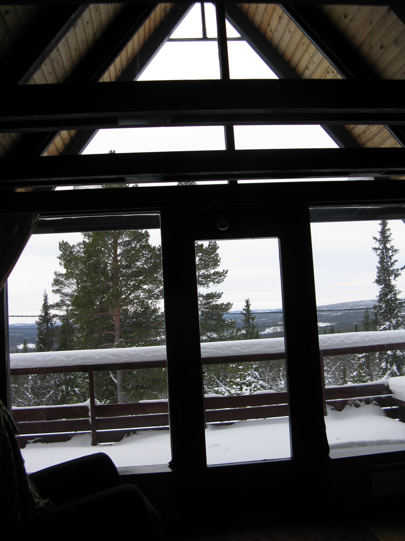
Being even farther north than Stockholm, at “high” noon, the sun was only 4.6
degrees above the horizon. Basically,
the day consisted of a three hour sunrise followed by a three hour sunset. With the sun being so low, you never felt
like it was daytime. It either felt like
early morning or late evening, but at least the sunrises and sunsets were
gorgeous with lots of red and pink and orange color.
 |
| 45 minutes into the sunrise... |
I’ve decided that in the winter in Sweden, there
is no such thing as high noon. Here, it
is low noon!
 |
| shadows at low noon |
Four Days in Hamburg
After
our four days in Berlin,
we took a 90 minute high speed train to visit friends in Hamburg.
I’d like to pause here for a moment and write about how amazingly simple
it is to travel around Europe. Yeah yeah, everyone knows this, Europe
has great public transportation, yeah yeah yeah. But really, looking at
Europe’s long distance
transportation through a Texas
lens gives me a fresh perspective.
From Stockholm, it is a 90
minute flight to Berlin. From San Antonio,
a 90 minute flight will get you to Dallas, or
maybe Oklahoma City
if you’re lucky. Not only can you fly to
13 or 14 other countries from Stockholm in 90 minutes, the flight costs about
as much as a Southwest flight between San Antonio and Dallas. I don’t know about you, but I’ll take cheap
and easy access to Berlin or London
or Amsterdam over Dallas any day!
Austin
and San Antonio are about 80 miles apart, yet the
train takes three and a half HOURS to go between the cities. This train
service is offered once per day. Berlin and Hamburg are about 180
miles apart, but the train only takes 90 minutes, and it costs about the
same
as the Austin-San Antonio trip (if you book the train ticket ahead).
There is an hourly train between Berlin and Hamburg,
so there’s very little stress about missing a train.
Our time in Hamburg
was wonderful. Knowing people in a new
town always makes the experience so much more personal and somehow, more real
as well. It was great to see how “real”
Hamburgers live, and interesting to compare a Hamburg
life with a Stockholm
life. Our friends’ apartment is about
the same size as the apartment we just bought, and they have the exact same
sleeper sofa that we intend to purchase from Ikea (at least half of the 50+
apartments we looked at had this exact same model—it’s relatively cheap, very
comfortable, and not bad looking). Our
friends live in an exceptionally vibrant and lively neighborhood—despite the
cold weather, hundreds of people were out enjoying the scene and sitting at
sidewalk bars. One of our Hamburg friends
spent part of his childhood living in Germany, so not only did we have
guides to show us around this city, but we also had a native to give us insight
into the German psyche.
Both of our Hamburg
friends are architects, so they were able to point out all the new, cool
building sites in town. Hamburg is building and building and building on even
more massive a scale than Berlin—the
new developments in the city are almost Dubai-scaled, and the architecture is
bold and daring and interesting. It
seems like most of the new development is on Hamburg’s
riverfront which was traditionally industrial in nature (Hamburg is one of the world’s busiest ports
despite its location 90 km inland).
 |
| it was a hazy day but this gives a glimpse of Hamburg's extensive port |
We
spent 2 days touring around the city, one day on foot, the next on bikes, and
while we didn’t have time to see everything
that Hamburg
has to offer, we did get a good feel for the town.
 |
| historic canal and warehouses |
Our friends also gave us a good introduction to the local
food. My husband tried a myriad of
Pilsners while I tried more “summery” beer drinks that involve adding Sprite or
fruit syrup. Both sound gross, but
actually, the fruit syrup beer was surprisingly tasty. We also tried local pastries, a steamed kale
and onion dish, a fried liver entrée, fish sandwiches, crab bratwurst, and a
fish salad.
The waterside fish market was the main attraction of our
Sunday. The market sells all kinds of
food in addition to fish, and the vendors all shout out to the crowds and give
a little show to try to attract attention.
One fruit vendor was even throwing bananas out to the crowd to try to
convince them to buy a fruit basket! We
enjoyed coffee and fresh pastries for our breakfast, and my husband bought a
smoked fish for his lunch.
One day, we took a quick train ride out of the city to the
magical town of Lüneburg
with our friends and guides. Much of
historic Hamburg
was destroyed in the World Wars, but Lüneburg was a small-enough town to
survive intact. It’s a pedestrian town
of 3-5 story brick buildings, and the brickwork is amazing in all shapes and
colors and textures. I was particularly
taken with the green and black glazed brick.
The town was so, so charming. So
charming I wanted to pinch the buildings’ cheeks!

There is something so pleasing and delightful in small towns
like that. You can walk from end to end
in 15 or 20 minutes, yet the walk is never dull because the buildings are all
different and visually interesting.
Because it’s a pedestrian-only town, everyone’s out walking, sitting in
cafes, getting their groceries, walking their dogs. The buildings are tall enough to make it feel
like a lively, urban environment, but they aren’t so tall that human scale is
lost. Businesses are small and local,
but seem to be thriving. Little open
squares with fountains and markets are scattered throughout the town. If you ever imagined a town as an incarnation
of “the good ol’ days,” Lüneburg is it.
 |
| many of Lüneburg's buildings look a little tipsy |
Four Days in Berlin
My husband has only been working here in Sweden since early August, but by the end of the year, he already will have earned two weeks of vacation! It’s pretty crazy since we took a two month hiatus this summer to visit New Zealand, but that’s what happens when you have five weeks of vacation mandated by law. And not only does Sweden understand that you cannot adequately rest and rejuvenate on two weeks of vacation per year, but Sweden also understands that sometimes, it takes a few weeks away to truly unwind. That’s why, by law, companies must allow employees to take at least three consecutive weeks of vacation. This is truly heaven for people who love to travel and explore as much as my husband and I!
Anyway, my husband is only allowed to carry one week of
vacation over from one year to the next.
Which meant that we just had
to use a week of vacation this fall! The
list of places that we’re excited to visit while we’re living in Europe
is
infinite—St. Petersburg, the Acropolis, Paris, a wine and cheese tour of
France, Rome, Venice…. I could go on. But for this trip, we decided
to go to Germany. I have friends from my architecture firm in San
Antonio that moved to Hamburg
a few years ago, and my husband has an aunt, uncle, and adult cousins
living in
Berlin. We hadn’t been able to make any stops in Germany on our
previous travels to Sweden, so we
felt it was high time!
Berlin
is overwhelming. Just look at this
subway map as an example:

Not only is the subway overwhelming, but the shear scale of Berlin is daunting. It is a huge city, with neighborhoods galore
to explore, as well as a number of gigantic museums on the scale and breath and
quality of anything in New York or Paris or London. When you only have 4 days, how do you choose?
The one major museum that we visited was the Pergamon
museum. It is famous for housing entire
pieces of ancient architecture, including its namesake Pergamon temple. It was amazing to see these pieces,
especially pieces of cities I have been to like Miletus
and Priene in Turkey.
However, it’s really pretty sad. I mean, the museum contains the gates of Babylon for heaven’s
sake! Don’t the gates of Babylon belong in Babylon?
 |
| Market Gates of Miletus and Gate of Babylon |
On our first evening, Carl’s uncle picked us up at our hotel
and gave us a driving and walking tour of downtown Berlin.
This tour helped us to get ourselves oriented in the city. After the walking tour, the three of us met
Carl’s cousin and his wife at a traditional German restaurant, and Carl’s uncle
proceeded to order and order and order until we were all so stuffed that we
could hardly move! First came half
liters of beer each and a full-sized pretzel appetizer for everyone. Then the entrée with another half liter of
beer each: the men shared a truly titanic sampler platter of nothing but
meat—several kinds of sausages, several kinds of meat dumplings, several kinds
of meatballs, etc—while we women both ordered wiener schnitzel. The wiener schnitzel was about 16 or 18
inches long, and about 8 inches wide.
Seriously. It was a lot of
food. And then there was desert, which
was 2 orders of stewed plums with German pancakes and vanilla ice cream, of course with
another half liter of beer each.
Whew! Unfortunately, we were not
able to meet up with Carl’s aunt, but I loved meeting his uncle and cousins and
enjoyed our conversation that was partly in Swedish, partly in English, and
partly in German.
Berlin
celebrates its gritty side. It is a
relatively poor town with lots of litter everywhere, unwashed,
pollution-blackened stone buildings, and post-industrial wastelands and
trash-filled abandoned lots scattered throughout the city. I’m making Berlin
sound unattractive, but while it’s not clean and pristine like Stockholm, it’s actually quite
attractive. Graffiti is an artform in Berlin—just about
everything is covered in it, but it’s not just tags with names of people and
gangs. In Berlin, graffiti tends to be political in
nature. It’s guerrilla art with a message.
Before the Berlin
wall came down, West-Berliners tagged their side of the wall with messages of
freedom, hopes for a peaceful world, and desires for an oppression-free
East-Berlin. Once the wall was breached
in 1989, most of the wall was torn down, but a kilometer-long stretch of wall
remains as a reminder of Berlin’s
divided past. This stretch of wall is
called the East Side Gallery, and in 1990 artists were invited to tag the wall
with their own interpretations of the meaning of the Berlin Wall. The result is a colorful, moving testament to
peace.
 |
| just a few sections of the East Side Gallery |
 |
| this section of wall made me teary |
Entire abandoned buildings have been requisitioned by
squatter artists and grafittied from foundation to roof. Wandering around these buildings is eerie,
but wonderful, too. In buildings
unwanted by mainstream society, artists have found a free place to practice and
sell their art.
 |
| Inside one squatter artist colony. I didn't feel comfortable taking photos of the artists' stalls, but the stairway seemed neutral enough for a photo. |
Berlin
is known for its “alternative” lifestyles.
Aside from the artist squatters, the political graffiti everywhere, and
gay couples openly expressing affection in public, we didn’t really see much alternative culture in Berlin. However, you could feel it. Berlin
feels very much like an “everything goes” kind of place. You didn’t feel like you had to conform or
fit in to a narrow societal box in order to be acknowledged. It’s a place where it’s ok to experiment.
This experimental quality of Berlin was especially evident in its
contemporary architecture. In Stockholm, contemporary
buildings tend to be nice and pleasant, but they don’t tend to push any
architectural boundaries. But in Berlin, many buildings are
quite different from anything that came before.
Not all of these experiments yielded great buildings, but at least they
tried something new and different.

Experimental
architecture has been a theme in Germany since
about 1900. Gropius and the Bauhaus
school were experimenting with modern architecture, and Mendlesohn and
others
were experimenting with expressionist architecture. But before 1900,
very little was experimental
in Germany. Instead, massive, giant-scaled Classical
buildings dominated the architecture scene.
Germany fancied
itself as an empire, but in a different way than Britain, say. I’m
certainly not a scholar of history, but with
Britain’s
empire, I get the sense that primarily it was an empire of economics.
But with Germany, I get the sense that the
drive for empire was more about power and militaristic might against its
close neighbors. By using imagery from the Greek and Roman
empires and amping up the scale beyond human proportions, Germany was
making the statement that they were
even more powerful than the Roman Empire. Unlike in Britain,
there is nothing graceful and delicate in Germany’s Classical
buildings. Instead, Berlin’s “temples” are dense, heavy,
unyielding, and dripping with ornamentation and statuary.

Aside from the remaining sections of Berlin
wall, it is hard for an outsider to see how split Berlin was even 20 years ago. Most of the urban fabric has been knit back
together, and you flow seamlessly from East to West Berlin
without knowing you have crossed the historic divide. Yet, I was constantly aware of Berlin’s tragic
past. Monuments and outdoor
informational museums frequently dot the city, and I learned quite a bit about
the Cold War era in Berlin. The fall of the Berlin Wall was one of the
first internationally significant, earth-shaking events I can remember
witnessing on television. Seeing photos of
East-Berliners finally breaching the wall on that fateful night in November,
1989 made me teary, but hopeful and optimistic about our world.
Just as the cold war is ever-present in Berlin, so is Hitler’s regime. Germany does not try to hide or
deny its shameful past; instead, it acknowledges it and makes it visible. The constant reminders of what can happen make
it less likely that it will ever happen again.
In the middle of Berlin,
an entire city block is dedicated to a memorial to Jews who died in the
Holocaust. It is difficult to analyze Peter Eisenman’s Memorial to the Murdered Jews of Europe to glean its underlying design meaning, but it is moving
none-the-less. Row upon row of giant
gray concrete columns march across the block.
The ground beneath the columns falls away toward the middle of the site,
so that as you walk between the 2711 columns, you eventually become engulfed by
them. The columns lean slightly, and in
combination with the undulating ground beneath you, they make you feel
disoriented in a chaotic world. You lose
sight of the city around you, and as you get deeper into the forest of columns,
you also lose audible contact with the city.
Suddenly, you are in a world by yourself, with occasional glimpses of
others walking through the memorial.
 |
| the memorial from the outside |
 |
| inside the memorial |
I don’t know the exact intended meaning
behind the memorial, but I still found it haunting and moving. Interestingly, it is similar but more
powerful than the Garden
of Exile at Daniel
Libeskind’s Jewish museum. Libeskind’s
49 concrete columns are taller and lean more, but the smaller scale of the Garden of Exile means that you never lose contact
with your surroundings.
 |
| Garden of Exile from the sidewalk (columns are about twice as tall as you can see in photo because Garden is sunken) |
I loved the exterior of Libeskind’s Jewish museum. The building is too huge to really get a
sense of the zig-zag plan, but you do see the windows slashed into the
structure. The cladding is a dark,
somber gray zinc paneling, and just to let the archi-dork in me out for a
moment, the flashing details were incredible!
 |
| building exterior and sidewalk |
Inside the museum, you again can’t sense the zig-zag plan, but I did
enjoy the seemingly random windows. The
museum itself wasn’t nearly as disorienting as I had expected—I think
Libeskind’s art museum in Denver
is probably more perplexing to navigate.
 |
| stair and exhibit space |
My favorite Berlin
experience was the “höfe,” pedestrian-accessible courtyards in the middle of
urban blocks.
 |
| extensive Hackesche Höfe |
These hofs are surrounded
by private buildings, but anyone is welcome to enter the courtyards. In places, several courtyards are linked by
small passageways, so the hofs become an entire secondary pedestrian network
through parts of the city. Generally,
the hofs are commercial in nature with small cafés, restaurants, and boutiques
at ground level. However, my favorite hof was purely residential and was a quiet, leafy oasis in
the middle of bustling, dense Berlin.
 |
| residential Riehmers Hofgarten |
A couple of things just for fun:
 |
| Chamberlain crushed car sculpture in the middle of a mall (of all places) |
 |
| solar powered electric bikes! |
A Weekend in Helsinki:
 |
| Lutheran cathedral looming over one Russian-sized square |
This
morning I returned from a last-minute long-weekend trip
to Helsinki. My husband’s office sent him for a
conference, so we decided to make a little mini-vacation out of it. My
husband flew over the Baltic while I took the all-day ferry over to
Finland.
Helsinki
is a great and beautiful city. Much like
Stockholm, it
is a city of water. However, unlike Stockholm, Helsinki does
not have a large archipelago around it and the city is much more exposed to the
Baltic Sea.
This exposure, in combination with its proximity to the freezing
hinterland of Russia, makes
it a little colder and windier and Helsinki
experiences more extreme winters than Stockholm. Also unlike Stockholm,
Helsinki is for the most part built on the
mainland, so it doesn’t have the “Venice of the
North” feel of Stockholm.
Helsinki was founded in 1550
by the Swedish king, but according to Lonely Planet, it “remained a backwater
market town on a windy, rocky peninsula” until 1748 when the Swedes built a
huge island fortress there to protect their Finnish interests from Russia. After Sweden
lost Finland to Russia in 1808, Russia
moved Finland’s capitol from
the west, Sweden-facing coast to Helsinki which
was a little easier for St. Petersburg
to keep an eye on. Other than the
fortress, none of the original Swedish Helsinki remains; the Russians hired a
German planner to design a new city center which
was modeled on neoclassical St.
Petersburg. Helsinki’s main squares
are giant spaces, definitely more on a titanic Russian scale than on an
intimate western European scale.
If you’re into Jugendstil/Art Nouveau and Art Deco
architecture, Helsinki
is your city. It seems that at least
half of the buildings in the city center were built from 1905 to 1930, and it is
like walking through a turn-of-the-century architecture history book. The Jugendstil in Helsinki
was a lot more restrained than in France,
Belgium, or Spain; in fact,
the Jugendstil is so restrained that it easily bleeds into a reserved Art Deco
neo-classicism. While Helsinki’s
Jugendstil buildings do explore Art Nouveau’s botanical themes with whipping
tendrils of vegetation, it is also mixed up with Finland’s National Romantic
movement and themes also tend toward the medieval.
 |
| on the more Jugendstil / Art Nouveau side of things |
 |
| and on the more Art Deco side of things |
There is also quite a bit of modern architecture in Helsinki. I have to admit that I didn’t go to many
Aalto buildings while I was there, but I did swing by his Finlandia Hall. Unexpectedly, because I don’t usually like design
from the 1960’s, my favorite building was Temppeliaukio Church
by Tuomo Suomalainen. It is built in the
middle of an open square that had never been built upon because it is occupied
by a giant granite outcropping. Instead
of trying to build on the outcropping,
Suomalainen built inside the
outcropping, hewing out a round sanctuary from the stone. The sanctuary is roofed by a giant floating
copper disk. There is glazing between
concrete arms supporting the copper disk, and the concrete arms are deep enough
to filter all but the most direct sunlight.
No matter the sun direction, the entire periphery of the church roof
subtly glows with this diffused light, and the copper disc really does look
like it is hovering unsupported over the sanctuary.

I’m
sad to say that Steven Holl’s Kiasma Contemporary
Art Museum wasn’t as cool
as I had hoped. The entire meaning of
the building is about connections to the existing urban fabric, but in
reality,
the building seems to be a blob plopped at the edge of a random park.
It isn’t weathering so well, either. And, most of the beautiful,
wall-grazing
daylit gallery spaces are daylit no longer—even though it is a
contemporary art
museum, the curators have sadly blacked out most of the windows.

Per capita, Helsinki
must have more high-design stores than any other city on the planet. I enjoyed looking, but we certainly didn’t
buy any 30,000 Euro sofas for our new apartment.
When you’re tired of hip and sleek and need a dose of cute
and cozy, I recommend a day-trip to nearby Porvoo. With its twisting lanes and small,
pastel-colored wooden houses, Porvoo gives you a sense of medieval Finland. It is situated just inland on a river, and
it’s riverside storehouses are delightful.

I highly recommend paying the extra 20 Euros to have your
own room on the overnight ferry between Helsinki
and Stockholm. I had the bad luck to room with a drunken,
60-year-old chain-smoking Finn who spent the entire night sneaking cigarettes
in the cabin’s bathroom, hacking with emphysema, and repeating the same few
sentences in a needlessly and thoughtlessly loud voice.
While I greatly enjoyed our little jaunt over the Baltic, I
was glad to pull into Stockholm
this morning (and not just because of my roommate). I am gladly amazed at how
quickly this city is starting to feel like home!
 |
| sunrise and the full-moonset from this morning's ferry as we glided through the archipelago--it's not like I was sleeping anyway! |
No comments:
Post a Comment